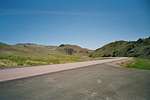
Wyoming Highway 34
The topic of this article may not meet Wikipedia's notability guideline for geographic features. (June 2023) |
| Laramie-Wheatland Road | ||||
WYO 34 highlighted in red | ||||
| Route information | ||||
| Maintained by WYDOT | ||||
| Length | 52.38 mi (84.30 km) | |||
| Existed | November 1949[1]–present | |||
| Major junctions | ||||
| West end | ||||
| East end | Frontage Road in Wheatland | |||
| Location | ||||
| Country | United States | |||
| State | Wyoming | |||
| Counties | Albany, Platte | |||
| Highway system | ||||
| ||||
| ||||
| ||||
Wyoming Highway 34 (WYO 34) is a 52.38-mile-long (84.30 km) Wyoming state highway known as Laramie-Wheatland Road. Located in Albany and Platte counties, it spans from U.S. Routes 30 and 287 near Bosler to Interstate 25 / U.S. Route 87 in Wheatland.
Route description
[edit]Wyoming Highway 34 has its west end at US 30 / US 287 near Bosler and travels from there northeast to Wheatland by the way of Morton Pass. Nearing its end, WYO 34 intersects the southern terminus of Wyoming Highway 312, which is the former routing of WYO 34 into Wheatland. Highway 34 comes to an end at I- 25 / US 87 (Exit 73) just south of Wheatland.[citation needed]
Wyoming 34 follows State Control Route S-109 for its entire length.[citation needed]
History
[edit]
Wyoming Highway 34 was formerly designated as Wyoming Highway 26 between 1926 and November 1949.[citation needed] The WYO 26 designation was before U.S. Route 26 was extended west across Wyoming to Wheatland where it ended at U.S. Route 87. When US 26 was designated, WYO 26 was renumbered WYO 34 to avoid confusion.[1]
Major intersections
[edit]| County | Location | mi | km | Destinations | Notes | |
|---|---|---|---|---|---|---|
| Albany | Bosler | 0.00 | 0.00 | Western terminus | ||
| Platte | Wheatland | 50.78 | 81.72 | Southern terminus of WYO 312 | ||
| 52.38 | 84.30 | Eastern terminus; I-25 exit 73 | ||||
1.000 mi = 1.609 km; 1.000 km = 0.621 mi
| ||||||
See also
[edit]References
[edit]- ^ a b "Wheatland-Bosler Road Gets New Designation". Casper Star-Tribune. November 22, 1949. p. 4. Retrieved December 21, 2019 – via Newspapers.com.


