Inselberg
An inselberg or monadnock (/məˈnædnɒk/ mə-NAD-nok) is an isolated rock hill, knob, ridge, or small mountain that rises abruptly from a gently sloping or virtually level surrounding plain. In Southern Africa, a similar formation of granite[citation needed] is known as a koppie, an Afrikaans word ("little head") from the Dutch diminutive word kopje.[1] If the inselberg is dome-shaped and formed from granite or gneiss, it can also be called a bornhardt, though not all bornhardts are inselbergs. An inselberg results when a body of rock resistant to erosion, such as granite, occurring within a body of softer rocks, is exposed by differential erosion and lowering of the surrounding landscape.[2]
Etymology
[edit]Inselberg
[edit]The word inselberg is a loan word from German, and means "island mountain". The term was coined in 1900 by geologist Wilhelm Bornhardt (1864–1946) to describe the abundance of such features found in eastern Africa.[3] At that time, the term applied only to arid landscape features. However, it has since been used to describe a broader geography and range of rock features, leading to confusion about the precise definition of the term.
In a 1973 study examining the use of the term, one researcher found that the term had been used for features in savannah climates 40% of the time, arid or semi-arid climates 32% of the time, humid-subtropical and arctic 12% of the time, and 6% each in humid-tropical and Mediterranean climates. A 1972 paper defined inselbergs as "steep-sided isolated hills rising relatively abruptly above gently sloping ground". This definition includes such features as buttes; conical hills with rectilinear sides typically found in arid regions; regolith-covered concave-convex hills; rock crests over regolith slopes; rock domes with near vertical sides; tors (koppies) formed of large boulders but with solid rock cores. Thus, the terms monadnock and inselberg may not perfectly match,[4] though some authors have explicitly argued these terms are completely synonymous.[5]
Monadnock
[edit]Monadnock is derived from an Abenaki term for an isolated hill or a lone mountain that stands above the surrounding area, typically by surviving erosion. Geologists took the name from Mount Monadnock in southwestern New Hampshire.[6] It is thought to derive from either menonadenak (transl. smooth mountain) or menadena (transl. isolated mountain).[7] In this context, monadnock is used to describe a mountain that rises from an area of relatively flat and/or lower terrain. For instance, Mount Monadnock rises 610 metres (2,000 ft) above its surrounding terrain and stands, at 965 m (3,165 ft), nearly 300 m (1,000 ft) higher than any mountain peak within 48 km (30 mi).[8]
Geology
[edit]Geological and geographical patterns
[edit]
Inselbergs are common in eroded and weathered shields.[9] The presence of an inselberg typically indicates the existence of a nearby plateau or highland, or their remnants. This is especially the case for inselbergs composed of sedimentary rock, which will display the same stratigraphic units as this nearby plateau. However once exposed, the inselbergs are destroyed by marginal collapse of joint blocks and exfoliation sheets. This process leaves behind tors perched at their summits and, over time, a talus-bordered residual known as a castle koppie appears.[10][11] By this association various inselberg fields in Africa and South America are assumed to be the vestiges of eroded etchplains.[12][13]
Clusters of inselbergs, called inselberg fields and inselberg plains, occur in various parts of the world, including Tanzania,[14] the Anti-Atlas of Morocco,[12] Northeast Brazil,[15] Namibia,[16] the interior of Angola,[17] and the northern portions of Finland[18][19] and Sweden.[20][A]
The classification of Anthony Young (1969) distinguishes six types of inselbergs; buttes, conical hills, convex-concave hills, rock crest over regolith-covered slope, rock dome (sugarloaf) and kopje or tor.[22]
The types of rock of which inselbergs are made include granite, gneiss and gabbro.[B]
Origin and development
[edit]This section needs expansion. You can help by adding to it. (October 2022) |
Summarizing the understanding on the origin of inselbergs in 1974, geomorphologist Michael Thomas writes "Hypotheses for the development of inselbergs have been advanced, refuted and reiterated over a period of more than seventy years."[24] Volcanic or other processes, such as a meteor crater, may give rise to a body of rock resistant to erosion, inside a body of softer rock such as limestone, which is more susceptible to erosion. When the less resistant rock is eroded away to form a plain, the more resistant rock is left behind as an isolated mountain. The strength of the uneroded rock is often attributed to the tightness of its jointing.[25][C]
Inselbergs can be reshaped by ice sheets much the same way as roches moutonnées. In northern Sweden, examples of this type of inselberg are called flyggbergs.[27]: 326–327 [28]
Ecology
[edit]
The inselbergs of Eastern Africa tend to be a refuge for life in the Serengeti of Tanzania and in the Masai Mara of Kenya. Where the soil is too thin or hard to support tree life in large areas, soil trapped by inselbergs can be dense with trees while the surrounding land contains only short grass. Hollows in the rock surfaces provide catchments for rainwater. Many animals have adapted to the use of inselbergs, including the lion, the hyrax, and an abundance of bird and reptile life.
Gallery
[edit]-
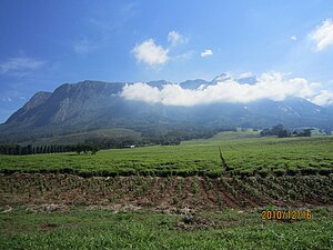
Mount Mulanje, a large inselberg in southeastern Malawi
-
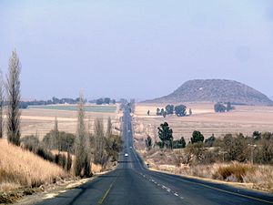
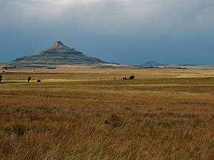
A conical sandstone koppie in the Free State, South Africa
-
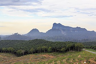
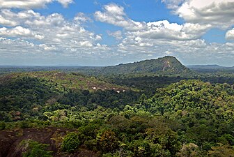
An inselberg in the rainforest of Suriname
-
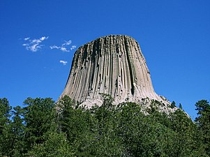
Devils Tower, an archetypal example of an inselberg in Wyoming, US
-
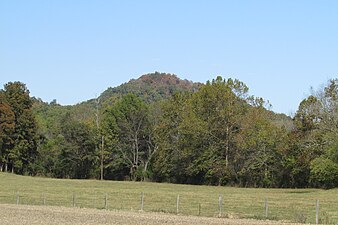
Vinyard Knob (high point 960') in the central portion of the Knobs Region of Kentucky
-
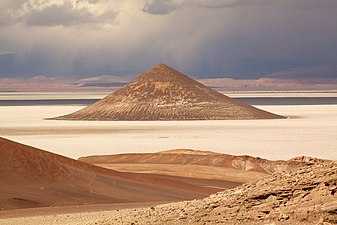
Cono de Arita, a conical sandstone inselberg in the middle of Salar de Arizaro, Argentina
-
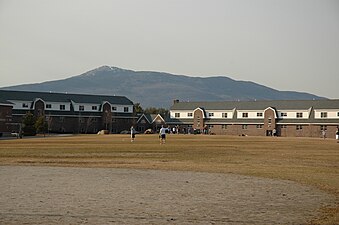
Mount Monadnock in New Hampshire, US
-
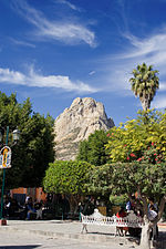
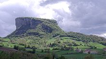
Peña de Bernal in Bernal, Querétaro, México
-
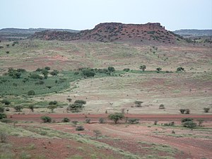
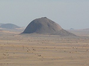
An inselberg in Western Sahara
-
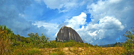
Peñón de Guatapé, Antioquia Department, Colombia
-
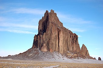
Shiprock, New Mexico
See also
[edit]- Bornhardt – A large dome-shaped, steep-sided, bald rock
- Caprock – Rock overlying a less resistant type
- Dissected plateau – Plateaus area that has been severely eroded so that the relief is sharp
- List of inselbergs
- Mesa – Elevated area of land with a flat top and sides, usually much wider than buttes
- Mogote – Steep-sided residual hill of limestone, marble, or dolomite on a flat plain
- Sky island – Geographic or environmental feature
- Table (landform) – Raised landform with a flat top
- Tuya – Flat-topped, steep-sided volcano formed when lava erupts through a thick glacier or ice sheet
Notes
[edit]- ^ Albeit its not the usual way of describing it the strandflat of Norway was held by Julius Büdel to be an etchplain with inselbergs.[21]
- ^ Cliff Ollier has noted that in Uganda inselbergs are commonly made of granite rock, sometimes of gneiss and never of amphibolite or volcanic rock.[2] According to Ollier protuding quartzite hills tend to form ridges rather than "true inselbergs".[2] Dundret in northern Sweden is made of gabbro.[23]
- ^ Twidale (1981) "Granitic Inselbergs: …"[26] is a review that follows the Willis 1936 works and Twidale 1971, a series of papers available in 1970 and rock weathering strata and structure reviewed U.C.W. well worth reading as they show by theory and materials the importance of preceding structures, internal solution, subsurface weathering, slips, exfoliation, basal weathering (Young, A. Soils), biological effects, plants, solutes and salt plain catena associations, possible lake rise, but mainly the stripping of rock mass leaving resistant units, sometimes volcanic plugs.
References
[edit]- ^ Webster's New Explorer Dictionary of Word Origins (2004). Federal Street Press: New York.
- ^ a b c Ollier, C.D. (1960). "The Inselbergs of Uganda". Zeitschrift für Geomorphologie. 4 (1): 43–52.
- ^ Holmes, Arthur (1978). Holmes Principles of Physical Geology. Nelson. ISBN 978-0-17-771299-9.[page needed]
- ^ Gerrard, John (1988). Rocks and Landforms Routledge: Florence, Kentucky.
- ^ King, Lester C. (1953). "Canons of landscape evolution". Geological Society of America Bulletin. 64 (7): 721. doi:10.1130/0016-7606(1953)64[721:COLE]2.0.CO;2.
- ^ Raymo, Chet and Raymo, Maureen E. (1989) Written in Stone: A Geologic History of the Northeastern United States. Globe Pequot, Chester, Connecticut.
- ^ "Vermont Soils with Names of American Indian Origin Archived 2009-03-20 at the Wayback Machine" United States Department of Agriculture, Natural Resources Conservation Service. Retrieved January 6, 2008.
- ^ Baldwin, Henry I. (1989). Monadnock Guide 4th edition. Concord, New Hampshire: Society for the Protection of New Hampshire Forests.
- ^ Nenonen, Keijo; Johansson, Peter; Sallasmaa, Olli; Sarala, Pertti; Palmu, Jukka-Pekka (2018). "The inselberg landscape in Finnish Lapland: a morphological study based on the LiDAR data interpretation". Bulletin of the Geological Society of Finland. 90 (2): 239–256. doi:10.17741/bgsf/90.2.008.
- ^ "Summary: Inselbergs/Hills/Knobs". Desert Processes Working Group. Knowledge Sciences, Inc. Retrieved 6 January 2008.
- ^ Easterbrook, Don J. (1999). "Chapter Three: Weathering". Surface Processes and Landforms (2nd ed.). Upper Saddle River, NJ: Prentice Hall.
- ^ a b Guillocheau, François; Simon, Brendan; Baby, Guillaume; Bessin, Paul; Robin, Cécile; Dauteuil, Olivier (2017). "Planation surfaces as a record of mantle dynamics: The case example of Africa" (PDF). Gondwana Research. 53: 82. Bibcode:2018GondR..53...82G. doi:10.1016/j.gr.2017.05.015.
- ^ García, Carolina; Hermelin, Michel (2016). "Inselbergs Near Medellín". In Hermelin, Michel (ed.). Landscapes and Landforms of Colombia. Springer. p. 219. ISBN 978-3-319-11800-0.
- ^ Sundborg, Å.; Rapp, A. (1986). Erosion and Sedimentation by Water: Problems and prospects. Ambio. pp. 215–225.
- ^ Maia, Rúbson Pinheiro; Frêgo Bezerra, Francisco Hilário; Leite Nascimento, Marcos Antônio; Sampaio de Castro, Henrique; de Andrade Meireles, Antônio Jeovah; Rothis, Luis Martin (2015). "Geomorfologia do Campo de Inselbergues de Quixadá, nordeste do Brasil" [Geomorphology of inselbergs field of Quixadá, Northeast Brazil]. Revista Brasileira de Geomorfologia (in Portuguese). 16 (2). doi:10.20502/rbg.v16i2.651. hdl:11336/6639.
- ^ "Production of an agro-ecological zones map of Namibia (first approximation)" (PDF). nbri.org.na.
- ^ "Development of a soil and terrain map/database for Angola" (PDF). Archived from the original (PDF) on 2021-03-09. Retrieved 2016-07-11.
- ^ Kaitanen, Veijo (1 February 1985). "Problems concerning the origin of inselbergs in Finnish Lapland". Fennia. 163 (2): 359–364.
- ^ Ebert, K.; Hall, A.; Hättestrand, C.; Alm, G. (2009). "Multi-phase development of a glaciated inselberg landscape". Geomorphology. 115 (1): 56–66. doi:10.1016/j.geomorph.2009.09.030.
- ^ Rudberg, S. (1988). "Gross morphology of Fennoskandia: Six complementary ways of explanation". Geografiska Annaler. A. Physical Geography. 70 (3): 135–167. doi:10.2307/521068. JSTOR 521068.
- ^ Olesen, Odleiv; Kierulf, Halfdan Pascal; Brönner, Marco; Dalsegg, Einar; Fredin, Ola; Solbakk, Terje (2013). "Deep weathering, neotectonics and strandflat formation in Nordland, northern Norway" (PDF). Norwegian Journal of Geology. 93: 189–213. S2CID 226225485.
- ^ Young, Anthony (1969). Clayton, K.M. (ed.). Slopes. Edinburgh: Oliver & Boyd. p. 209.
- ^ Ebert, Karin; Hall, Adrian M.; Hättestrand, Clas (2012). "Pre-glacial landforms on a glaciated shield: The inselberg plains of northern Sweden". Norwegian Journal of Geology. 92: 1–17.
- ^ Thomas, Michael (1974). Tropical Geomorphology. The Macmillan Press Ltd. p. 136.
- ^ "A Dictionary of Ecology" (2004). Encyclopedia.com. Retrieved November 28, 2009
- ^ Twidale, C.R. (1981). "Granitic Inselbergs: Domed, Block-Strewn and Castellated". The Geographical Journal. 147 (1): 54–71. doi:10.2307/633409. JSTOR 633409.
- ^ Benn, Douglas; Evans, David (1998). Glaciers & Glaciation (1st ed.). London, UK: Arnold. ISBN 978-0-340-58431-6.
- ^ Lidmar-Bergström, Karna; Olvmo, Mats (2015). Plains, Steps, Hilly Relief and Valleys in Northern Sweden--review, Interpretations and Implications for Conclusions on Phanerozoic Tectonics (PDF). Sveriges geologiska undersökning (Geological Survey of Sweden). p. 13. ISBN 978-91-7403-308-3. OCLC 943395499. Retrieved 29 June 2016.
External links
[edit]- Chisholm, Hugh, ed. (1911). . Encyclopædia Britannica (11th ed.). Cambridge University Press.

