Baishan
Baishan
白山市 | |
|---|---|
Fusong Ski resort Fifteen Gou Baishan Panoramio Baishan Railway Station | |
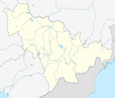
 Location of Baishan City (yellow) in Jilin (light grey) and China | |
| Coordinates (Baishan municipal government): 41°56′38″N 126°24′53″E / 41.9440°N 126.4147°E | |
| Country | People's Republic of China |
| Province | Jilin |
| County-level divisions | 6 |
| Incorporated (city) | 8 September 1986 |
| Renamed | 31 January 1994 |
| Municipal seat | Hunjiang District |
| Government | |
| • Type | Prefecture-level city |
| • CPC Committee Secretary | Xiang Hui (向辉) |
| • Mayor | Wang Xuefeng (王雪峰) |
| Area | |
| 17,485 km2 (6,751 sq mi) | |
| • Urban (2017)[1] | 388.11 km2 (149.85 sq mi) |
| Elevation | 471 m (1,545 ft) |
| Population (2010) | |
| 1,296,575 | |
| • Density | 74/km2 (190/sq mi) |
| • Urban (2017)[1] | 402,600 |
| • Urban density | 1,000/km2 (2,700/sq mi) |
| GDP[2] | |
| • Prefecture-level city | CN¥ 66.9 billion US$ 10.7 billion |
| • Per capita | CN¥ 53,137 US$ 8,531 |
| Time zone | UTC+8 (China Standard) |
| Postal code | 134300 |
| Area code | 0439 |
| ISO 3166 code | CN-JL-06 |
| Licence plates | 吉F |
| Website | bs.jl.gov.cn |
Baishan (Chinese: 白山; pinyin: Báishān), is a prefecture-level city in southeastern Jilin province, in the Dongbei (northeastern) part of China. "白山" literally means "White Mountain", and is named after Changbai Mountain (Chinese: 长白山; pinyin: Chángbái Shān). Baishan borders Yanbian to the east, Tonghua to the southwest, Jilin City to the north, and North Korea to the south.
Baishan is to be granted the title of China International Mineral Water City. In Baishan is the Baishan Dam.
History
[edit]In 1902, Qing imperial government set up the Linjiang County in today's Baishan region. During the Manchukuo period, Linjiang county was under the jurisdiction of Tonghua. In March 1959, Jilin provincial government promoted Linjiang County to a county-level city and renamed it as Hunjiang City, which is still under the administration of Tonghua Prefecture. In 1985, Hunjiang City developed into a prefecture-level city, administerring three districts and three counties including Fusong, Jingyu and Changbai. The city was renamed to Baishan in April, 1994 with the approval of the State Council.[3]
Administrative divisions
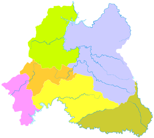
[edit]| Map | ||||||
|---|---|---|---|---|---|---|
| # | Name | Hanzi | Hanyu Pinyin | Population (2003 est.) | Area (km2) | Density (/km2) |
| 1 | Hunjiang District | 浑江区 | Húnjiāng Qū | 330,000 | 1,388 | 238 |
| 2 | Jiangyuan District | 江源区 | Jiāngyuán Qū | 260,000 | 1,348 | 193 |
| 3 | Linjiang City | 临江市 | Línjiāng Shì | 180,000 | 3,009 | 60 |
| 4 | Fusong County | 抚松县 | Fǔsōng Xiàn | 300,000 | 6,150 | 49 |
| 5 | Jingyu County | 靖宇县 | Jìngyǔ Xiàn | 140,000 | 3,094 | 45 |
| 6 | Changbai Korean Autonomous County | 长白朝鲜族自治县 | Chángbái Cháoxiǎnzú Zìzhìxiàn | 80,000 | 2,496 | 32 |
Climate
[edit]| Climate data for Baishan, elevation 521 m (1,709 ft), (1991–2020 normals, extremes 1981–2010) | |||||||||||||
|---|---|---|---|---|---|---|---|---|---|---|---|---|---|
| Month | Jan | Feb | Mar | Apr | May | Jun | Jul | Aug | Sep | Oct | Nov | Dec | Year |
| Record high °C (°F) | 3.4 (38.1) |
11.8 (53.2) |
16.5 (61.7) |
29.2 (84.6) |
32.2 (90.0) |
35.5 (95.9) |
35.8 (96.4) |
35.7 (96.3) |
30.1 (86.2) |
27.2 (81.0) |
18.3 (64.9) |
8.3 (46.9) |
35.8 (96.4) |
| Mean daily maximum °C (°F) | −7.1 (19.2) |
−2.7 (27.1) |
4.3 (39.7) |
13.9 (57.0) |
20.7 (69.3) |
24.9 (76.8) |
27.3 (81.1) |
26.5 (79.7) |
21.8 (71.2) |
14.0 (57.2) |
3.1 (37.6) |
−5.5 (22.1) |
11.8 (53.2) |
| Daily mean °C (°F) | −14.7 (5.5) |
−10.2 (13.6) |
−2.1 (28.2) |
6.8 (44.2) |
13.5 (56.3) |
18.4 (65.1) |
21.8 (71.2) |
20.6 (69.1) |
14.2 (57.6) |
6.2 (43.2) |
−3.2 (26.2) |
−12.2 (10.0) |
4.9 (40.9) |
| Mean daily minimum °C (°F) | −20.8 (−5.4) |
−16.7 (1.9) |
−7.8 (18.0) |
0.3 (32.5) |
6.8 (44.2) |
12.9 (55.2) |
17.5 (63.5) |
16.4 (61.5) |
8.8 (47.8) |
0.3 (32.5) |
−8.3 (17.1) |
−17.8 (0.0) |
−0.7 (30.7) |
| Record low °C (°F) | −35.5 (−31.9) |
−32.0 (−25.6) |
−24.6 (−12.3) |
−11.4 (11.5) |
−3.9 (25.0) |
3.4 (38.1) |
7.9 (46.2) |
3.1 (37.6) |
−4.4 (24.1) |
−12.7 (9.1) |
−26.5 (−15.7) |
−32.7 (−26.9) |
−35.5 (−31.9) |
| Average precipitation mm (inches) | 11.2 (0.44) |
18.1 (0.71) |
27.8 (1.09) |
47.6 (1.87) |
86.1 (3.39) |
116.2 (4.57) |
200.0 (7.87) |
188.8 (7.43) |
65.1 (2.56) |
46.8 (1.84) |
40.2 (1.58) |
18.8 (0.74) |
866.7 (34.09) |
| Average precipitation days (≥ 0.1 mm) | 9.9 | 7.9 | 9.8 | 10.5 | 14.3 | 15.4 | 15.9 | 15.1 | 9.4 | 9.9 | 10.6 | 11.5 | 140.2 |
| Average snowy days | 12.8 | 11.1 | 11.9 | 5.0 | 0.2 | 0 | 0 | 0 | 0 | 3.1 | 11.2 | 15.1 | 70.4 |
| Average relative humidity (%) | 70 | 66 | 61 | 57 | 64 | 74 | 81 | 83 | 78 | 69 | 72 | 72 | 71 |
| Mean monthly sunshine hours | 163.5 | 174.5 | 201.3 | 198.5 | 220.0 | 203.0 | 181.7 | 188.1 | 199.0 | 185.4 | 143.5 | 141.5 | 2,200 |
| Percent possible sunshine | 55 | 58 | 54 | 49 | 49 | 45 | 40 | 44 | 54 | 55 | 49 | 50 | 50 |
| Source: China Meteorological Administration[4][5] | |||||||||||||
Transportation
[edit]References
[edit]- ^ a b Ministry of Housing and Urban-Rural Development, ed. (2019). China Urban Construction Statistical Yearbook 2017. Beijing: China Statistics Press. p. 50. Archived from the original on 18 June 2019. Retrieved 11 January 2020.
- ^ 吉林省统计局、国家统计局吉林调查总队 (September 2016). 《吉林统计年鉴-2016》. China Statistics Press. ISBN 978-7-5037-7899-5. Archived from the original on 2018-04-28. Retrieved 2017-06-05.
- ^ "Profile of Baishan" (in Chinese). Official website of Baishan City Government. Archived from the original on 2008-04-15. Retrieved 2011-04-04.
- ^ 中国气象数据网 – WeatherBk Data (in Simplified Chinese). China Meteorological Administration. Retrieved 7 July 2023.
- ^ "Experience Template" 中国气象数据网 (in Simplified Chinese). China Meteorological Administration. Retrieved 7 July 2023.


