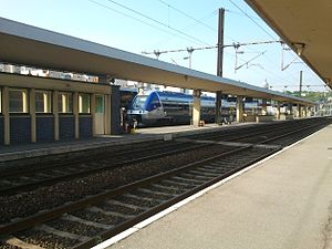
Boulogne-Ville station
Boulogne-Ville | ||||||||||||||||||||||||||
|---|---|---|---|---|---|---|---|---|---|---|---|---|---|---|---|---|---|---|---|---|---|---|---|---|---|---|
 Boulogne-Ville station | ||||||||||||||||||||||||||
| General information | ||||||||||||||||||||||||||
| Line(s) | Boulogne–Calais railway Longueau–Boulogne railway | |||||||||||||||||||||||||
| Other information | ||||||||||||||||||||||||||
| Station code | 87317586 | |||||||||||||||||||||||||
| History | ||||||||||||||||||||||||||
| Opened | 1850s (original site) 1962 (new site) | |||||||||||||||||||||||||
| Services | ||||||||||||||||||||||||||
| ||||||||||||||||||||||||||
| Other services | ||||||||||||||||||||||||||
| ||||||||||||||||||||||||||
Boulogne-Ville is one of the railway stations serving the town Boulogne-sur-Mer, Pas-de-Calais department, northern France. The other station is Boulogne-Tintelleries.
History
[edit]The railway reached Boulogne in 1848. Passengers had to use a goods terminal until Boulogne-Ville was built in the 1850s. The building was of red and yellow bricks on a stone base, with red, yellow and white mortar.[1] On 12 May 1902, the Chemin de fer de Boulogne à Bonningues (CF de BB) extended its line from Saint-Martin-Boulogne to the Quai Chanzy, outside Boulogne-Ville station.[2] The CF de BB closed on 31 December 1935, apart from a freight service at the Bonningues-lès-Ardres end of the line.[3] The station was destroyed during World War II.[1] Boulogne-Ville station was rebuilt in 1962–63 on a new site, on the opposite bank of the Liane.[4]
Services
[edit]The station is situated on the Longueau-Boulogne railway, and is served by local TER Hauts-de-France services from Boulogne to Lille-Flandres, Calais to Amiens and between Boulogne and Dunkerque.[5] There is also a TGV service to Lille-Europe via Calais-Fréthun which takes 55 minutes.
References
[edit]- ^ a b Farebrother & Farebrother 2008, pp. 25, 29.
- ^ Farebrother & Farebrother 2008, pp. 139, 146.
- ^ Farebrother & Farebrother 2008, p. 237.
- ^ Farebrother & Farebrother 2008, p. 264.
- ^ Plan du réseau, TER Hauts-de-France, accessed 14 April 2022.
Sources
[edit]- Farebrother, Martin J B; Farebrother, Joan S (2008). Tortillards of Artois. Usk: The Oakwood Press. ISBN 978-0-85361-554-5.
50°42′56″N 1°36′36″E / 50.71556°N 1.61000°E
