
File:West Okement River map.png
Size of this preview: 403 × 599 pixels. Other resolutions: 161 × 240 pixels | 323 × 480 pixels | 1,015 × 1,508 pixels.
Original file (1,015 × 1,508 pixels, file size: 202 KB, MIME type: image/png)
| This is a file from the Wikimedia Commons. Information from its description page there is shown below. Commons is a freely licensed media file repository. You can help. |
Summary
| Description |
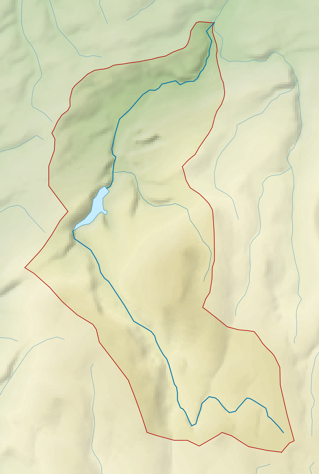
English: Map of the West Okement River and its catchment in Devon, UK. |
| Date | |
| Source |
|
| Author | Nilfanion, created using Ordnance Survey data |
| Permission (Reusing this file) |
This file is licensed under the Creative Commons Attribution-Share Alike 3.0 Unported license. Attribution: Contains Ordnance Survey data © Crown copyright and database right
|
File history
Click on a date/time to view the file as it appeared at that time.
| Date/Time | Thumbnail | Dimensions | User | Comment | |
|---|---|---|---|---|---|
| current | 22:48, 21 February 2014 | | 1,015 × 1,508 (202 KB) | Nilfanion | == {{int:filedesc}} == {{Information |Description= {{en|Map of the West Okement River and its catchment in Devon, UK.}} |Source=Ordnance Survey [https://www.ordnancesurvey.co.uk/opendatadownload/products.html OpenData]. *Relief da... |
File usage
The following page uses this file: