
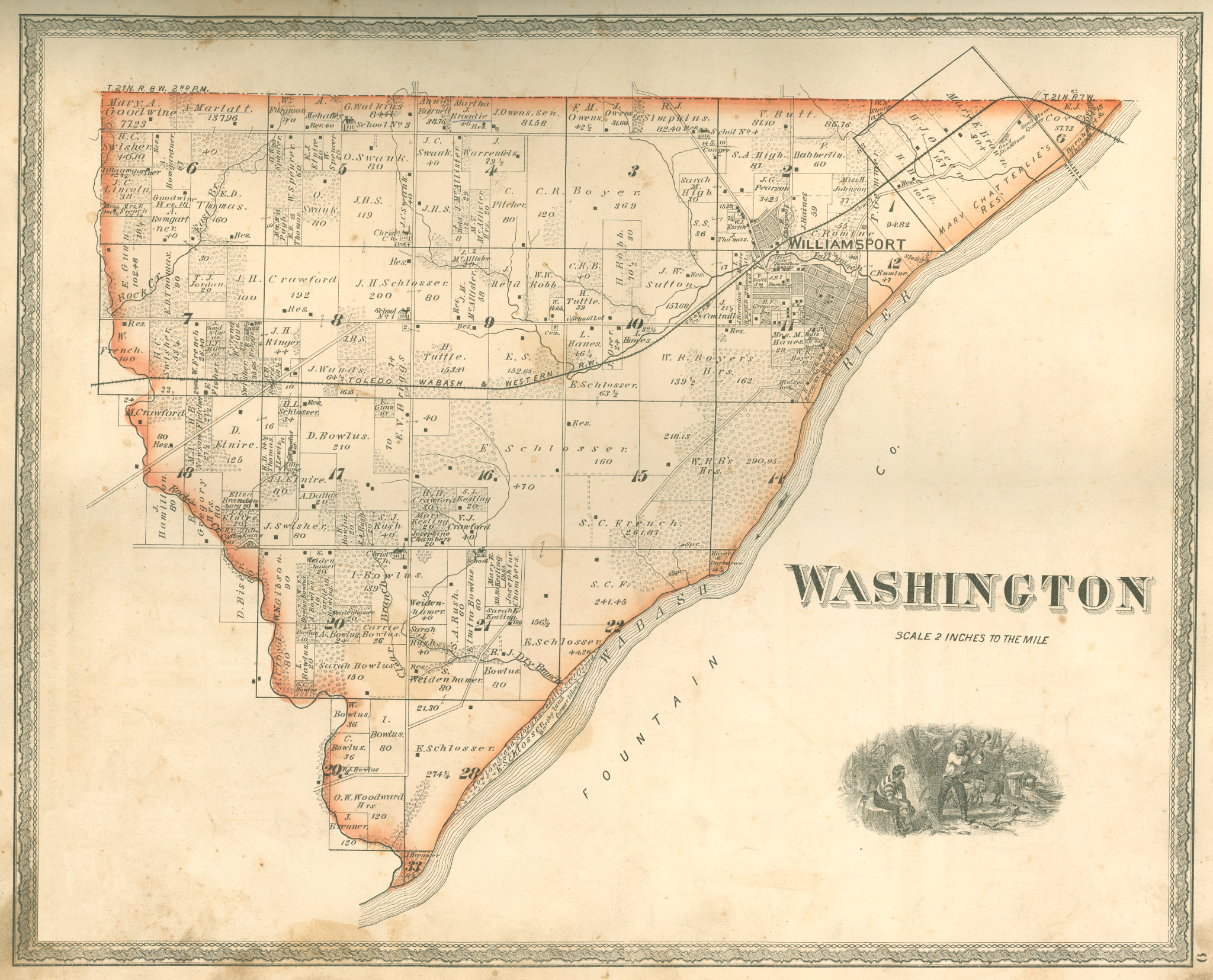
File:Washington Township, Warren County, Indiana map from 1877 atlas.png
Size of this preview: 742 × 600 pixels. Other resolutions: 297 × 240 pixels | 594 × 480 pixels | 950 × 768 pixels | 1,267 × 1,024 pixels | 2,048 × 1,655 pixels.
Original file (2,048 × 1,655 pixels, file size: 6.52 MB, MIME type: image/png)
| This is a file from the Wikimedia Commons. Information from its description page there is shown below. Commons is a freely licensed media file repository. You can help. |
Summary
| Description | A map of Washington Township, Warren County, Indiana from an 1877 county atlas. |
| Date | |
| Source | Atlas of Warren County, Indiana |
| Author | J. H. Beers and Company, Chicago |
| Open this image as an overlay in Google Earth (Google Maps, Bing) | (Help|Source) |
Licensing
This media file is in the public domain in the United States. This applies to U.S. works where the copyright has expired, often because its first publication occurred prior to January 1, 1929, and if not then due to lack of notice or renewal. See this page for further explanation.
|
 | |
 |
File history
Click on a date/time to view the file as it appeared at that time.
| Date/Time | Thumbnail | Dimensions | User | Comment | |
|---|---|---|---|---|---|
| current | 01:46, 16 September 2010 | | 2,048 × 1,655 (6.52 MB) | Omnedon | == {{int:filedesc}} == {{Information |Description=A map of Washington Township, Warren County, Indiana from an 1877 county atlas. |Source=Atlas of Warren County, Indiana |Date=1877 |Author=J. H. Beers and |
File usage
The following 2 pages use this file: