
File:WASACE submarine cable route map.svg

Size of this PNG preview of this SVG file: 800 × 536 pixels. Other resolutions: 320 × 214 pixels | 640 × 429 pixels | 1,024 × 686 pixels | 1,280 × 858 pixels | 2,560 × 1,715 pixels | 1,624 × 1,088 pixels.
Original file (SVG file, nominally 1,624 × 1,088 pixels, file size: 1.66 MB)
| This is a file from the Wikimedia Commons. Information from its description page there is shown below. Commons is a freely licensed media file repository. You can help. |
Summary
| Description |
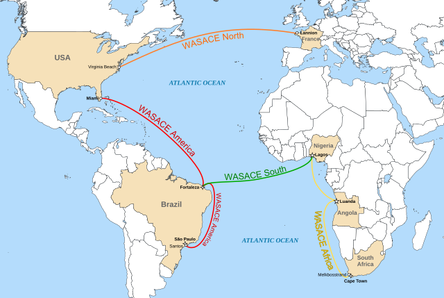
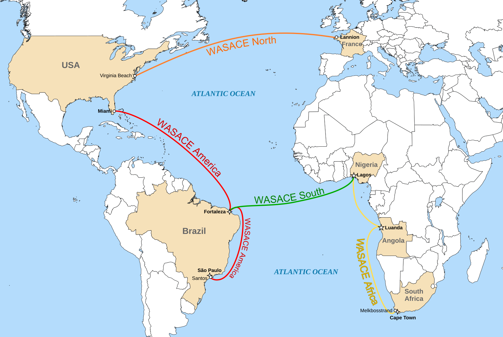
English: route map of the WASACE submarine cable connecting South Africa, Angola, Nigeria, Brazil, USA and France |
| Date | |
| Source |
Derivated from |
| Author | Cvdr |
Licensing
I, the copyright holder of this work, hereby publish it under the following license:
This file is licensed under the Creative Commons Attribution-Share Alike 3.0 Unported license.
- You are free:
- to share – to copy, distribute and transmit the work
- to remix – to adapt the work
- Under the following conditions:
- attribution – You must give appropriate credit, provide a link to the license, and indicate if changes were made. You may do so in any reasonable manner, but not in any way that suggests the licensor endorses you or your use.
- share alike – If you remix, transform, or build upon the material, you must distribute your contributions under the same or compatible license as the original.
File history
Click on a date/time to view the file as it appeared at that time.
| Date/Time | Thumbnail | Dimensions | User | Comment | |
|---|---|---|---|---|---|
| current | 22:48, 28 July 2020 | | 1,624 × 1,088 (1.66 MB) | Hogweard | South Sudan border |
| 22:37, 27 December 2011 |  | 1,624 × 1,088 (1.65 MB) | Cvdr | added São Paulo | |
| 20:58, 27 December 2011 |  | 1,624 × 1,088 (1.66 MB) | Cvdr |
File usage
The following pages on the English Wikipedia use this file (pages on other projects are not listed):