
File:ValcourIslandMap1776Overview.jpg
Size of this preview: 800 × 506 pixels. Other resolutions: 320 × 202 pixels | 640 × 404 pixels | 837 × 529 pixels.
Original file (837 × 529 pixels, file size: 213 KB, MIME type: image/jpeg)
| This is a file from the Wikimedia Commons. Information from its description page there is shown below. Commons is a freely licensed media file repository. You can help. |
Summary
| Description |
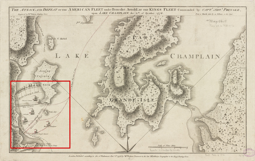
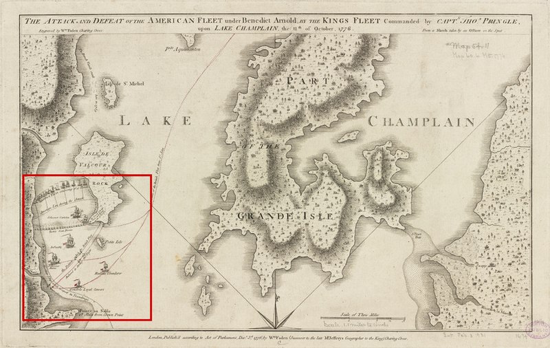
English: This is a 1776 map showing part of Lake Champlain and the action of the Battle of Valcour Island. The area showing the action has been highlighted with a red outline. The original map's border has also been cropped.
The map's caption reads: The attack and defeat of the American fleet under Benedict Arnold, by the King's fleet commanded by Capt. Thos. Pringle, upon Lake Champlain, the 11th of October, 1776 |
||||||||||||||||||||||
| Date | |||||||||||||||||||||||
| Source |
From the Boston Public Library Digital Map Collection (http://maps.bpl.org/). |
||||||||||||||||||||||
| Author |
|
||||||||||||||||||||||
Licensing
|
This work is in the public domain in its country of origin and other countries and areas where the copyright term is the author's life plus 100 years or fewer. | |
| This file has been identified as being free of known restrictions under copyright law, including all related and neighboring rights. | |
File history
Click on a date/time to view the file as it appeared at that time.
| Date/Time | Thumbnail | Dimensions | User | Comment | |
|---|---|---|---|---|---|
| current | 21:15, 17 February 2009 | | 837 × 529 (213 KB) | Magicpiano | {{Information |Description={{en|1=This is a 1776 map showing part of Lake Champlain and the action of the Battle of Valcour Island. The area showing the action has been highlighted with a red outline. } |
File usage
The following page uses this file:
Global file usage
The following other wikis use this file:
- Usage on de.wiki.x.io
- Usage on es.wiki.x.io
- Usage on it.wiki.x.io