
File:Ulster and Delaware route map.jpg
Size of this preview: 800 × 480 pixels. Other resolution: 320 × 192 pixels.
Original file (1,000 × 600 pixels, file size: 280 KB, MIME type: image/jpeg)
Summary
[edit]
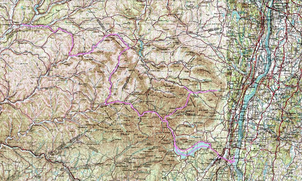
Ulster and Delaware route map. Base map is from public-domain USGS maps.
Licensing
[edit]
| I, the copyright holder of this work, hereby release it into the public domain. This applies worldwide. If this is not legally possible: |
 | This file is a candidate to be copied to Wikimedia Commons.
Any user may perform this transfer; refer to Wikipedia:Moving files to Commons for details. If this file has problems with attribution, copyright, or is otherwise ineligible for Commons, then remove this tag and DO NOT transfer it; repeat violators may be blocked from editing. Other Instructions
| ||
| |||
| This media file is either in the public domain or published under a free license, and contains no inbound file links. If this media file is useful, then it should be transferred to the Wikimedia Commons. If this media is not useful, then please propose it for deletion or list it at files for discussion. |
File history
Click on a date/time to view the file as it appeared at that time.
| Date/Time | Thumbnail | Dimensions | User | Comment | |
|---|---|---|---|---|---|
| current | 07:54, 3 December 2007 | | 1,000 × 600 (280 KB) | RussNelson (talk | contribs) | Ulster and Delaware route map. Base map is from public-domain USGS maps. |
You cannot overwrite this file.
File usage
No pages on the English Wikipedia use this file (pages on other projects are not listed).