
File:USACE Divide Cut map large.png
Size of this preview: 800 × 522 pixels. Other resolutions: 320 × 209 pixels | 640 × 418 pixels | 1,024 × 669 pixels | 1,280 × 836 pixels | 1,902 × 1,242 pixels.
Original file (1,902 × 1,242 pixels, file size: 560 KB, MIME type: image/png)
| This is a file from the Wikimedia Commons. Information from its description page there is shown below. Commons is a freely licensed media file repository. You can help. |
| Description |
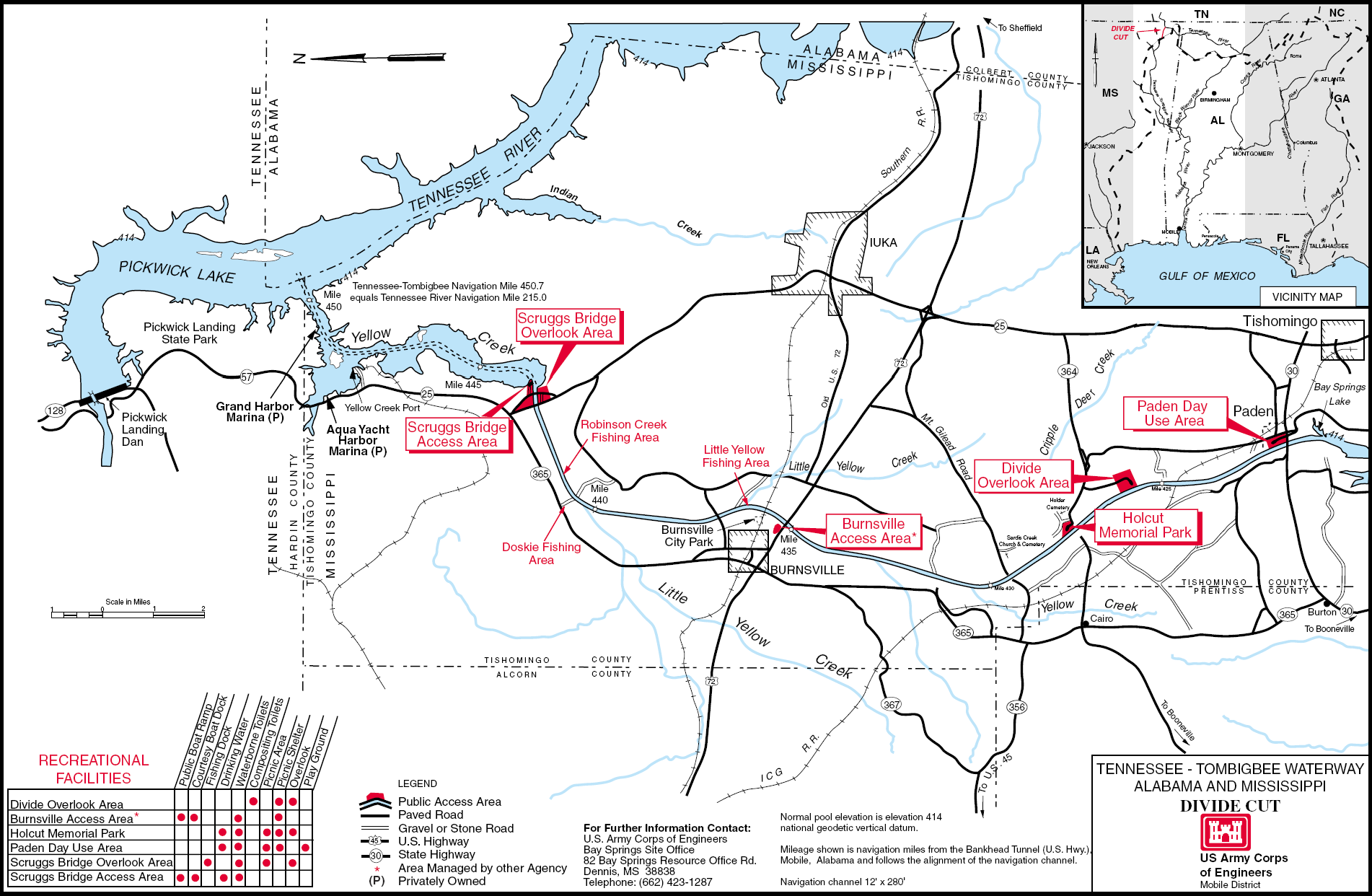
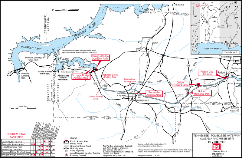
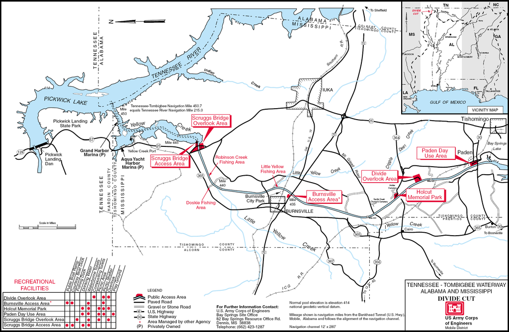
English: Detailed map of the Divide Cut on the Tennessee-Tombigbee Waterway in the U.S. State of Mississippi. PDF file saved as PNG. |
|||
| Location | Mississippi, USA | |||
| Date | not specified or unknown | |||
| Source |
U.S. Army Corps of Engineers Image page (PDF) Map description page |
|||
| Author | U.S. Army Corps of Engineers, artist not specified or unknown | |||
| Permission (Reusing this file) |
|
File history
Click on a date/time to view the file as it appeared at that time.
| Date/Time | Thumbnail | Dimensions | User | Comment | |
|---|---|---|---|---|---|
| current | 21:09, 25 March 2007 | | 1,902 × 1,242 (560 KB) | DanMS | {{Information | Description = {{en|Detailed map of the Divide Cut on the Tennessee-Tombigbee Waterway in the U.S. State of Mississippi. PDF file saved as PNG.}} | Source = U.S. Army Corps of Engineers<br />[http://tenntom.sam.usace.army.mil/pdf |
File usage
The following pages on the English Wikipedia use this file (pages on other projects are not listed):
Global file usage
The following other wikis use this file:
- Usage on hu.wiki.x.io