
File:Serbia-0333 - Tunnel to the Petrovaradin Fortress (7170042269).jpg

Size of this preview: 800 × 531 pixels. Other resolutions: 320 × 213 pixels | 640 × 425 pixels | 1,024 × 680 pixels | 1,280 × 850 pixels | 2,560 × 1,700 pixels | 4,288 × 2,848 pixels.
Original file (4,288 × 2,848 pixels, file size: 11.67 MB, MIME type: image/jpeg)
| This is a file from the Wikimedia Commons. Information from its description page there is shown below. Commons is a freely licensed media file repository. You can help. |
Summary
| Description |
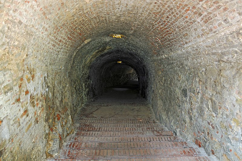
English: A long tunnel that goes to the fortress.
Petrovaradin Fortress is a fortress in Novi Sad, on the right bank of the Danube river. The cornerstone of the present-day southern part of the fortress was laid on October 18, 1692. Petrovaradin Fortress has many underground tunnels as well (16 km of underground countermine system). Recent archeological discoveries have offered a new perspective not only on the history of Petrovaradin, but on the entire region. At the Upper Fortress, the remains of an earlier Paleolithic settlement dating from 19,000 to 15,000 BC has been discovered. With this new development it has been established that there has been a continuous settlement at this site from the Paleolithic age to the present. During the excavations carried out in 2005, archeologists also discovered another significant find. Examining remains from the early Bronze age (c. 3000 BC), ramparts were discovered which testify that already at that time a fortified settlement existed at the Petrovaradin site. |
||||||||||||||
| Date | |||||||||||||||
| Source |
Serbia-0333 - Tunnel to the Petrovaradin Fortress
|
||||||||||||||
| Author |
|
||||||||||||||
.jpg)
.jpg)
| Camera location | | View this and other nearby images on: OpenStreetMap |
|---|
.jpg¶ms=045.254105_N_0019.851608_E_globe:Earth_type:camera_source:Flickr_&language=en)
Licensing
This file is licensed under the Creative Commons Attribution-Share Alike 2.0 Generic license.
- You are free:
- to share – to copy, distribute and transmit the work
- to remix – to adapt the work
- Under the following conditions:
- attribution – You must give appropriate credit, provide a link to the license, and indicate if changes were made. You may do so in any reasonable manner, but not in any way that suggests the licensor endorses you or your use.
- share alike – If you remix, transform, or build upon the material, you must distribute your contributions under the same or compatible license as the original.
| This image, originally posted to Flickr, was reviewed on 21 June 2013 by the administrator or reviewer File Upload Bot (Magnus Manske), who confirmed that it was available on Flickr under the stated license on that date. |
File history
Click on a date/time to view the file as it appeared at that time.
| Date/Time | Thumbnail | Dimensions | User | Comment | |
|---|---|---|---|---|---|
| current | 20:01, 21 June 2013 | | 4,288 × 2,848 (11.67 MB) | File Upload Bot (Magnus Manske) | Transferred from Flickr by User:High Contrast |
File usage
The following pages on the English Wikipedia use this file (pages on other projects are not listed):
Global file usage
The following other wikis use this file:
- Usage on fr.wiki.x.io
.jpg)