
File:Sarawak municipal map.svg

Size of this PNG preview of this SVG file: 800 × 584 pixels. Other resolutions: 320 × 234 pixels | 640 × 467 pixels | 1,024 × 747 pixels | 1,280 × 934 pixels | 2,560 × 1,869 pixels | 2,740 × 2,000 pixels.
Original file (SVG file, nominally 2,740 × 2,000 pixels, file size: 631 KB)
| This is a file from the Wikimedia Commons. Information from its description page there is shown below. Commons is a freely licensed media file repository. You can help. |
Summary
| Description |
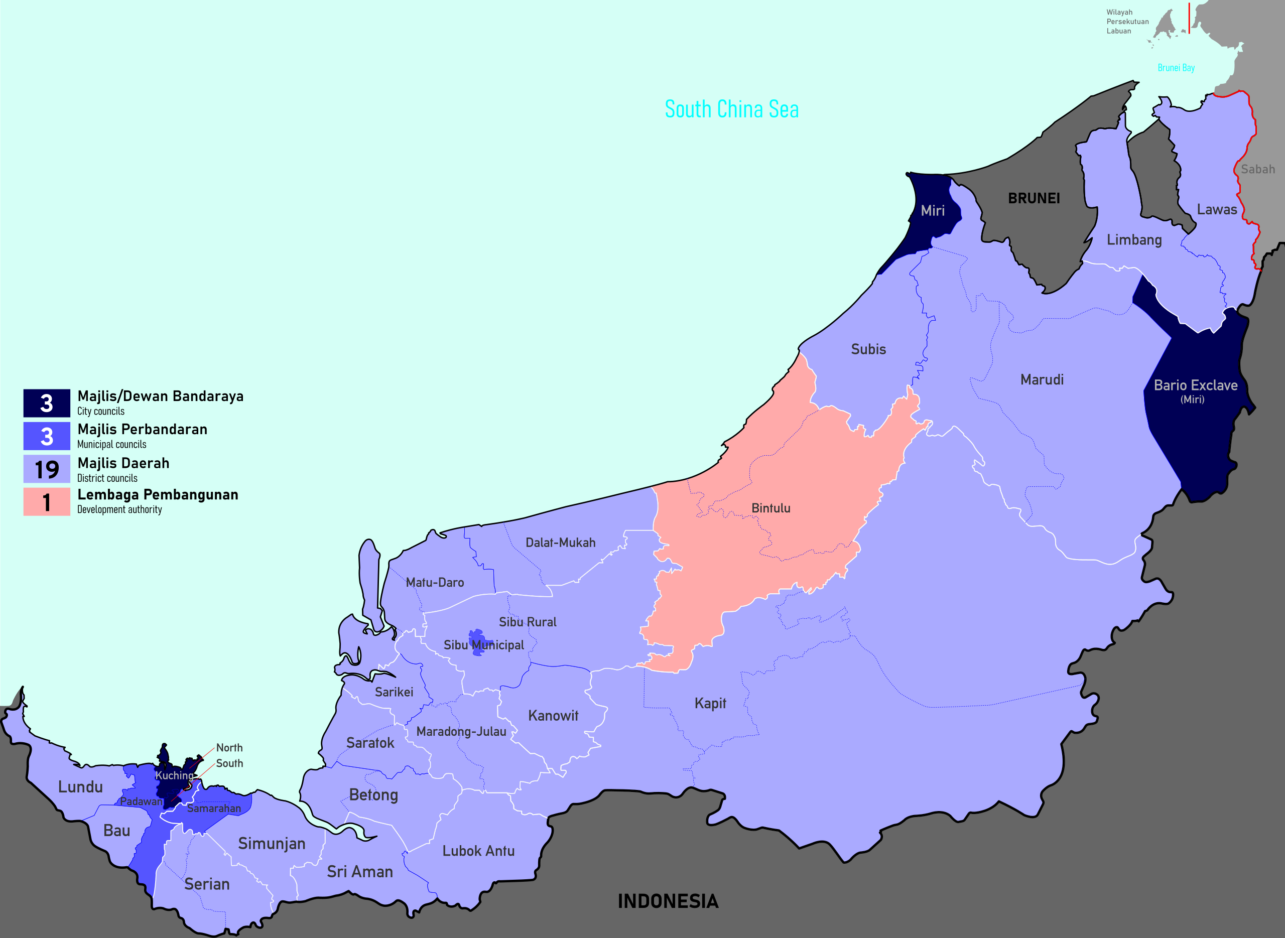
English: Map of local authorities in Sarawak, Malaysia. A local authority's jurisdiction may cover more than one district; those are depicted with dotted lines. White lines are division boundaries. Autonomous subdistricts (daerah kecil) not shown. |
| Date | |
| Source | Own work |
| Author | Derkommander0916 |
| Camera location | | View this and other nearby images on: OpenStreetMap |
|---|
Licensing
I, the copyright holder of this work, hereby publish it under the following license:
This file is licensed under the Creative Commons Attribution 4.0 International license.
- You are free:
- to share – to copy, distribute and transmit the work
- to remix – to adapt the work
- Under the following conditions:
- attribution – You must give appropriate credit, provide a link to the license, and indicate if changes were made. You may do so in any reasonable manner, but not in any way that suggests the licensor endorses you or your use.
File history
Click on a date/time to view the file as it appeared at that time.
| Date/Time | Thumbnail | Dimensions | User | Comment | |
|---|---|---|---|---|---|
| current | 16:54, 2 July 2024 | | 2,740 × 2,000 (631 KB) | Derkommander0916 | +Number count |
| 16:50, 2 July 2024 |  | 2,740 × 2,000 (630 KB) | Derkommander0916 | Uploaded own work with UploadWizard |
File usage
The following page uses this file: