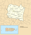
File:San Sebastián, Puerto Rico locator map.png
Appearance

Size of this preview: 541 × 600 pixels. Other resolutions: 216 × 240 pixels | 433 × 480 pixels | 693 × 768 pixels | 1,102 × 1,222 pixels.
Original file (1,102 × 1,222 pixels, file size: 188 KB, MIME type: image/png)
File history
Click on a date/time to view the file as it appeared at that time.
| Date/Time | Thumbnail | Dimensions | User | Comment | |
|---|---|---|---|---|---|
| current | 03:11, 2 August 2020 |  | 1,102 × 1,222 (188 KB) | The Eloquent Peasant | FIX BOTTOM LEFT CORNER BORDER OF SAN SEBASTIAN |
| 01:48, 28 July 2020 |  | 1,102 × 1,222 (188 KB) | The Eloquent Peasant | minor fix to text | |
| 12:35, 27 July 2020 |  | 1,102 × 1,222 (188 KB) | The Eloquent Peasant | replaced blue color on bottom so as not to look like ocean | |
| 03:29, 27 July 2020 |  | 1,103 × 1,356 (191 KB) | The Eloquent Peasant | added inset and labels | |
| 02:19, 16 June 2019 |  | 847 × 653 (104 KB) | The Eloquent Peasant | User created page with UploadWizard |
File usage
The following 2 pages use this file:
