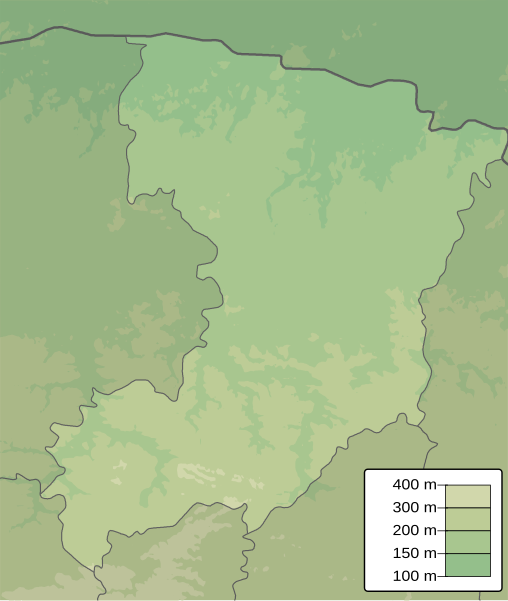
File:Rivne province physical map.svg
Appearance

Size of this PNG preview of this SVG file: 508 × 600 pixels. Other resolutions: 203 × 240 pixels | 406 × 480 pixels | 650 × 768 pixels | 867 × 1,024 pixels | 1,734 × 2,048 pixels | 531 × 627 pixels.
Original file (SVG file, nominally 531 × 627 pixels, file size: 527 KB)
File history
Click on a date/time to view the file as it appeared at that time.
| Date/Time | Thumbnail | Dimensions | User | Comment | |
|---|---|---|---|---|---|
| current | 06:17, 20 December 2010 |  | 531 × 627 (527 KB) | Urutseg |
File usage
The following 7 pages use this file:
Global file usage
The following other wikis use this file:
- Usage on ar.wiki.x.io
- Usage on be.wiki.x.io
- Usage on bg.wiki.x.io
- Usage on ceb.wiki.x.io
- Usage on ce.wiki.x.io
- Usage on da.wiki.x.io
- Usage on de.wiki.x.io
- Usage on eo.wiki.x.io
- Usage on es.wiki.x.io
- Usage on fi.wiki.x.io
- Usage on fr.wiki.x.io
- Rivne
- Viliya (village)
- Doubno
- Zdolbouniv
- Berezne
- Doubrovytsia
- Korets
- Ostroh
- Varach
- Kostopil
- Sarny
- Radyvyliv
- Sosnove
- Volodymyrets
- Rafalivka
- Mizotch
- Zaritchne
- Mlyniv
- Stepan
- Orjiv
- Demydivka
- Klevan
- Hochtcha
- Klessiv
- Kvassyliv
- Rokytne (oblast de Rivne)
- Smyha
- Tomachhorod
- Modèle:Géolocalisation/Oblast de Rivne
- Yassynets
View more global usage of this file.
