
File:Rincon Mountain District map.png
Size of this preview: 800 × 467 pixels. Other resolutions: 320 × 187 pixels | 640 × 374 pixels | 1,024 × 598 pixels | 1,599 × 934 pixels.
Original file (1,599 × 934 pixels, file size: 344 KB, MIME type: image/png)
| This is a file from the Wikimedia Commons. Information from its description page there is shown below. Commons is a freely licensed media file repository. You can help. |
| Description |
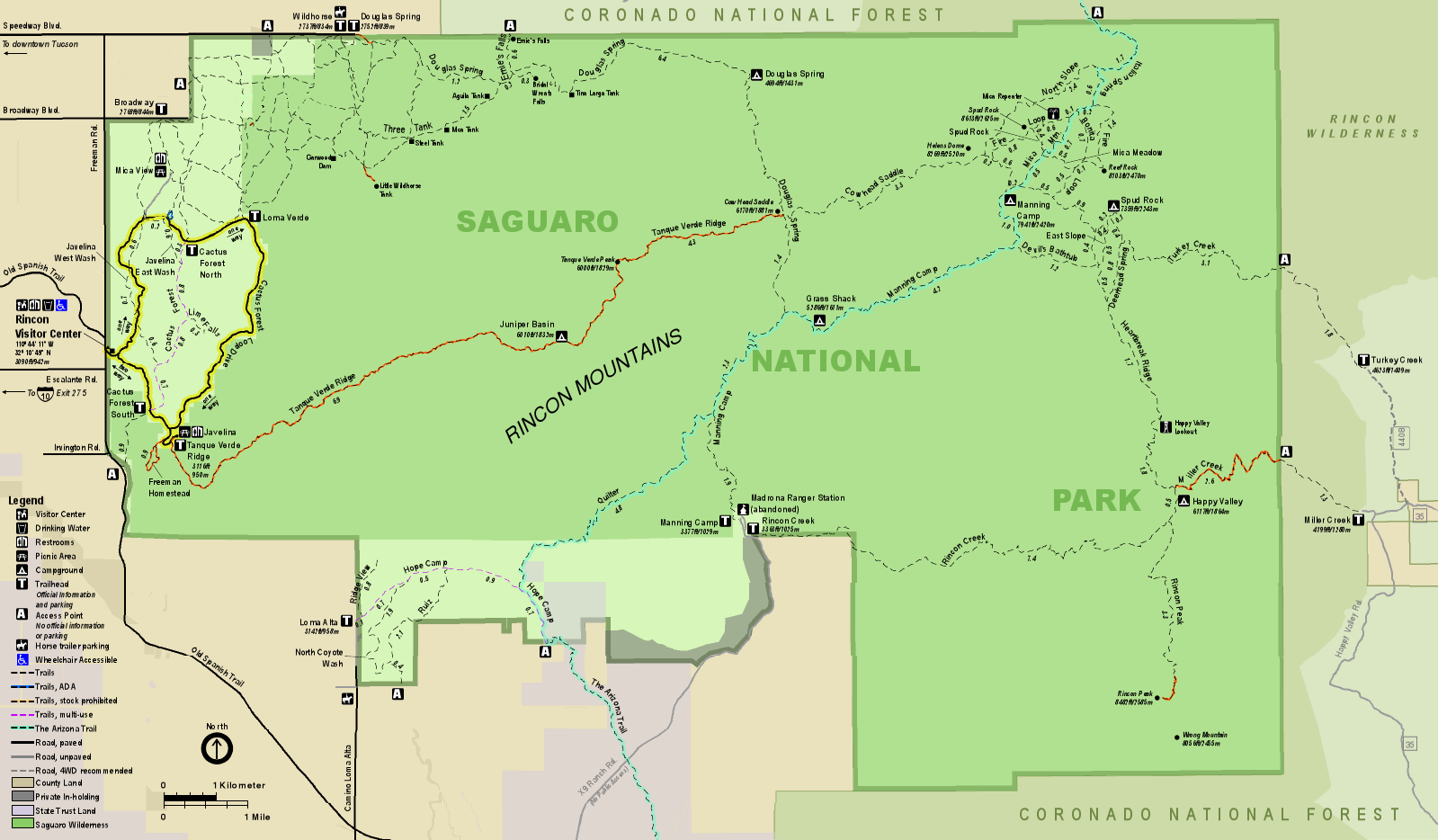
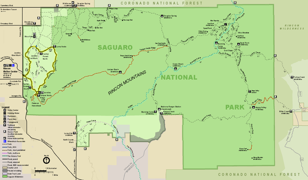
English: Map of the Rincon Mountain District of Saguaro National Park in the U.S. state of Arizona |
|||
| Date | (date of upload); unknown date of creation of the original | |||
| Source | official park map | |||
| Author | National Park Service; converted from PDF to PNG format by User:Finetooth using GNU Image Manipulation Program (GIMP) software | |||
| Permission (Reusing this file) |
|
File history
Click on a date/time to view the file as it appeared at that time.
| Date/Time | Thumbnail | Dimensions | User | Comment | |
|---|---|---|---|---|---|
| current | 21:06, 12 June 2017 | | 1,599 × 934 (344 KB) | Finetooth | {{Information |Description ={{en|1=Map of the Rincon Mountain District of Saguaro National Park in the U.S. state of Arizona}} |Source =[https://www.nps.gov/sagu/planyourvisit/upload/sentinel_2013_rmd.pdf official park map] |Author =... |
File usage
The following page uses this file:
Global file usage
The following other wikis use this file:
- Usage on ca.wiki.x.io
- Usage on he.wiki.x.io