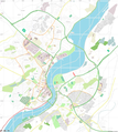
File:Open street map derry londonderry.png
Appearance

Size of this preview: 537 × 600 pixels. Other resolutions: 215 × 240 pixels | 430 × 480 pixels | 916 × 1,023 pixels.
Original file (916 × 1,023 pixels, file size: 654 KB, MIME type: image/png)
File history
Click on a date/time to view the file as it appeared at that time.
| Date/Time | Thumbnail | Dimensions | User | Comment | |
|---|---|---|---|---|---|
| current | 19:38, 28 April 2021 |  | 916 × 1,023 (654 KB) | Sheila1988 | shaded the river blue |
| 21:18, 2 May 2018 |  | 2,248 × 2,511 (1.78 MB) | SpanishSnake | final window dimentions | |
| 17:48, 2 May 2018 |  | 2,047 × 1,333 (1.34 MB) | SpanishSnake | new map | |
| 12:59, 2 May 2018 |  | 229 × 351 (91 KB) | SpanishSnake | {{Information |description ={{en|1={{Open Street Map}}}} |source =https://www.openstreetmap.org |author =Open Street Map |date = }} Category:Maps of Derry |
File usage
The following 13 pages use this file:
- Altnagelvin Area Hospital
- Bogside
- Celtic Park (Derry)
- Derry ~ Londonderry railway station
- Enagh Lough
- Guildhall, Derry
- Ryan McBride Brandywell Stadium
- St Columb's Cathedral
- St Columba's Church, Long Tower
- St Eugene's Cathedral
- Void Gallery
- Module:Location map/data/United Kingdom Derry
- Module:Location map/data/United Kingdom Derry/doc
Global file usage
The following other wikis use this file:
- Usage on ca.wiki.x.io
- Usage on fr.wiki.x.io
- Usage on ga.wiki.x.io
- Usage on ja.wiki.x.io
- Usage on si.wiki.x.io
- Usage on uz.wiki.x.io
- Usage on www.wikidata.org

