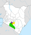
File:Nairobi Metro location map.png
Appearance
Nairobi_Metro_location_map.png (545 × 600 pixels, file size: 171 KB, MIME type: image/png)
File history
Click on a date/time to view the file as it appeared at that time.
| Date/Time | Thumbnail | Dimensions | User | Comment | |
|---|---|---|---|---|---|
| current | 09:13, 7 August 2013 |  | 545 × 600 (171 KB) | Nairobi123 | User created page with UploadWizard |
File usage
The following 25 pages use this file:
- Athi River (town)
- Juja
- Kajiado County
- Kangundo
- Karuri
- Kiambu
- Kiambu County
- Kikuyu, Kenya
- Kitengela
- Konza Technopolis
- Limuru
- Machakos
- Machakos County
- Mlolongo
- Nairobi
- Nairobi City County
- Ngong, Kenya
- Ongata Rongai
- Real estate in Kenya
- Ruiru
- Tala, Kenya
- Tatu City
- Thika
- User talk:MbithemwikaliPrime/sandbox
- Template:Nairobi metropolitan area
Global file usage
The following other wikis use this file:
- Usage on ca.wiki.x.io
- Usage on ceb.wiki.x.io
- Usage on es.wiki.x.io
- Usage on sv.wiki.x.io
- Usage on www.wikidata.org

