
File:NASA FIRMS 2025-01-05 Baltiysk.png
Size of this preview: 800 × 297 pixels. Other resolutions: 320 × 119 pixels | 1,037 × 385 pixels.
Original file (1,037 × 385 pixels, file size: 709 KB, MIME type: image/png)
| This is a file from the Wikimedia Commons. Information from its description page there is shown below. Commons is a freely licensed media file repository. You can help. |
Summary
| Description |
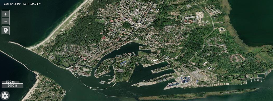
English: NASA FIRMS imagery 2025-01-05 of Baltiysk port. NB. The terrain imagery is older and undated |
| Date | |
| Source | https://firms.modaps.eosdis.nasa.gov/map/#d:2025-01-05;l:fires_all,earth;@19.93,54.64,14.00z |
| Author | Imagery from LANCE FIRMS operated by NASA's Earth Science Data and Information System (ESDIS) with funding provided by NASA Headquarters. |
| Camera location | | View this and other nearby images on: OpenStreetMap |
|---|
Licensing
| This file is in the public domain in the United States because it was solely created by NASA. NASA copyright policy states that "NASA material is not protected by copyright unless noted". (See Template:PD-USGov, NASA copyright policy page or JPL Image Use Policy.) | ||
 |
Warnings:
|
| Annotations | This image is annotated: View the annotations at Commons |
File history
Click on a date/time to view the file as it appeared at that time.
| Date/Time | Thumbnail | Dimensions | User | Comment | |
|---|---|---|---|---|---|
| current | 23:33, 10 January 2025 | 1,037 × 385 (709 KB) | Lklundin | Uploaded a work by Imagery from LANCE FIRMS operated by NASA's Earth Science Data and Information System (ESDIS) with funding provided by NASA Headquarters. from https://firms.modaps.eosdis.nasa.gov/map/#d:2025-01-05;l:fires_all,earth;@19.93,54.64,14.00z with UploadWizard |
File usage
The following page uses this file: