
File:Muswell Hill station, 1920.png

Size of this preview: 800 × 460 pixels. Other resolutions: 320 × 184 pixels | 640 × 368 pixels | 1,071 × 616 pixels.
Original file (1,071 × 616 pixels, file size: 966 KB, MIME type: image/png)
| This is a file from the Wikimedia Commons. Information from its description page there is shown below. Commons is a freely licensed media file repository. You can help. |
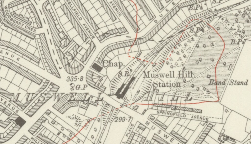
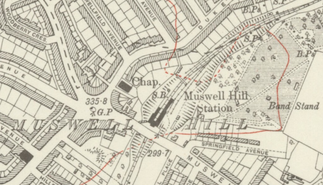
| Description | Muswell Hill station in north London on a 1920 Ordnance Survey map. |
| Date | |
| Source | Ordnance Survey London Sheet G, revised 1912-13, published 1920. Original Scale: Six Inches to One Mile/880 feet to One Inch. |
| Author | Ordnance Survey |
This work is an Ordnance Survey map over 50 years old, which is covered by Crown Copyright which in this case expires 50 years after publication. Ordnance Survey does however ask that they be credited and that the date of publication be given.
Any ancillary rights gained through the creation of the electronic version are granted as freely usable under any circumstances.
|
This work created by the United Kingdom Government is in the public domain.
This is because it is one of the following:
HMSO has declared that the expiry of Crown Copyrights applies worldwide (ref: HMSO Email Reply)
|
 |
File history
Click on a date/time to view the file as it appeared at that time.
| Date/Time | Thumbnail | Dimensions | User | Comment | |
|---|---|---|---|---|---|
| current | 22:27, 6 September 2015 | | 1,071 × 616 (966 KB) | DavidCane | {{Information |Description=Muswell Hill station in north London on a 1920 Ordnance Survey map. |Source=Ordnance Survey London Sheet G, revised 1912-13, published 1920. Origi... |
File usage
The following page uses this file:
Global file usage
The following other wikis use this file:
- Usage on www.wikidata.org