
File:Mexico map, MX-QUE.svg

Size of this PNG preview of this SVG file: 800 × 544 pixels. Other resolutions: 320 × 218 pixels | 640 × 435 pixels | 1,024 × 696 pixels | 1,280 × 870 pixels | 2,560 × 1,741 pixels | 1,000 × 680 pixels.
Original file (SVG file, nominally 1,000 × 680 pixels, file size: 123 KB)
| This is a file from the Wikimedia Commons. Information from its description page there is shown below. Commons is a freely licensed media file repository. You can help. |
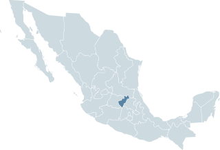
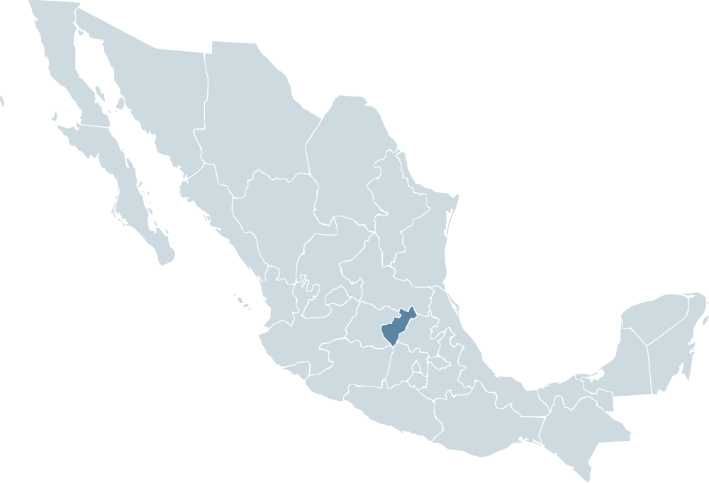
| Description | Locator map for the state of Querétaro within Mexico. | ||||
| Date | 04-07-2007 | ||||
| Source | Mexico template.svg by Mario Fuente Cid and Lokal_Profil | ||||
| Author | Lokal_Profil | ||||
| Permission (Reusing this file) |
Original image licensed under
|
File history
Click on a date/time to view the file as it appeared at that time.
| Date/Time | Thumbnail | Dimensions | User | Comment | |
|---|---|---|---|---|---|
| current | 00:08, 18 November 2009 | | 1,000 × 680 (123 KB) | Addicted04 | Reverted to version as of 19:38, 19 November 2007 |
| 01:46, 1 October 2009 |  | 1,000 × 680 (267 KB) | Addicted04 | States borders | |
| 19:38, 19 November 2007 |  | 1,000 × 680 (123 KB) | El bart089 | updated version, based on map made by Lokal Profil. | |
| 17:27, 4 July 2007 |  | 1,000 × 680 (117 KB) | Lokal Profil | {{Information |Description=Locator map for the state of Category:Querétaro within Mexico. |Source=Image:Mexico template.svg by Mario Fuente Cid <small>and Lokal_Profil</small> |Date=04-07-2007 |Author= |
File usage
The following pages on the English Wikipedia use this file (pages on other projects are not listed):
Global file usage
The following other wikis use this file:
- Usage on an.wiki.x.io
- Usage on ay.wiki.x.io
- Usage on ceb.wiki.x.io
- Usage on chy.wiki.x.io
- Usage on en.wiktionary.org
- Usage on es.wiki.x.io
- Usage on fr.wiki.x.io
- Usage on hr.wiki.x.io
- Usage on incubator.wikimedia.org
- Usage on ja.wiki.x.io
- Usage on ka.wiki.x.io
- Usage on ms.wiki.x.io
- Usage on nn.wiki.x.io
- Usage on pl.wiki.x.io
- Usage on pt.wiki.x.io
- Usage on ru.wiki.x.io
- Usage on sco.wiki.x.io
- Usage on sh.wiki.x.io
- Usage on sv.wiki.x.io
- Usage on sw.wiki.x.io
- Usage on www.wikidata.org