File:Mapa león LE-20 LE-30.png
Appearance
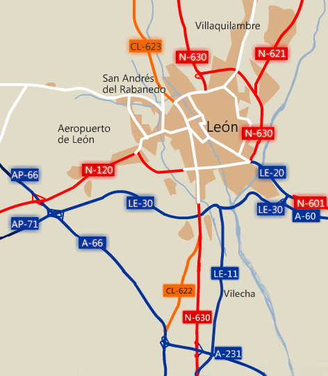
Mapa_león_LE-20_LE-30.png (472 × 542 pixels, file size: 100 KB, MIME type: image/png)
File history
Click on a date/time to view the file as it appeared at that time.
| Date/Time | Thumbnail | Dimensions | User | Comment | |
|---|---|---|---|---|---|
| current | 21:23, 19 October 2012 |  | 472 × 542 (100 KB) | Faelomx | + CL-622 |
| 15:33, 18 October 2012 |  | 476 × 513 (87 KB) | Faelomx | + LE-11 + A-231 + A-60 | |
| 02:34, 26 September 2011 |  | 481 × 392 (62 KB) | Faelomx | +ríos Todo lo descrito en la imagen anterior es aplicable a esta. | |
| 02:28, 26 September 2011 |  | 468 × 380 (55 KB) | Faelomx | {{Information |Description ={{en|1=Map of the city of León (ES)}} |Source ={{own}} |Author =Faelomx |Date =FECHA DE SUBIDA/UPLOAD DATE |Permission = |other_versions = }} {{Cc-by-sa-2.5-es}} cartografía: |
File usage
The following page uses this file:
Global file usage
The following other wikis use this file:
- Usage on azb.wiki.x.io
- Usage on es.wiki.x.io
- Usage on nl.wiki.x.io
- Usage on www.wikidata.org


