
File:Map of Hadhrami emigrations.svg

Size of this PNG preview of this SVG file: 800 × 516 pixels. Other resolutions: 320 × 206 pixels | 640 × 413 pixels | 1,024 × 660 pixels | 1,280 × 825 pixels | 2,560 × 1,650 pixels | 1,863 × 1,201 pixels.
Original file (SVG file, nominally 1,863 × 1,201 pixels, file size: 1.64 MB)
| This is a file from the Wikimedia Commons. Information from its description page there is shown below. Commons is a freely licensed media file repository. You can help. |
Summary
| Description |
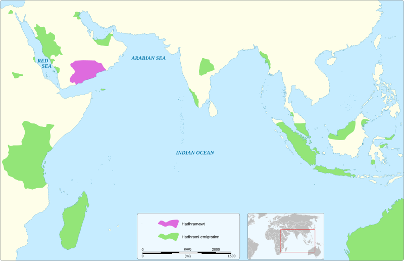
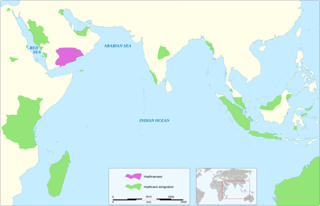
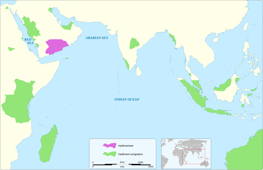
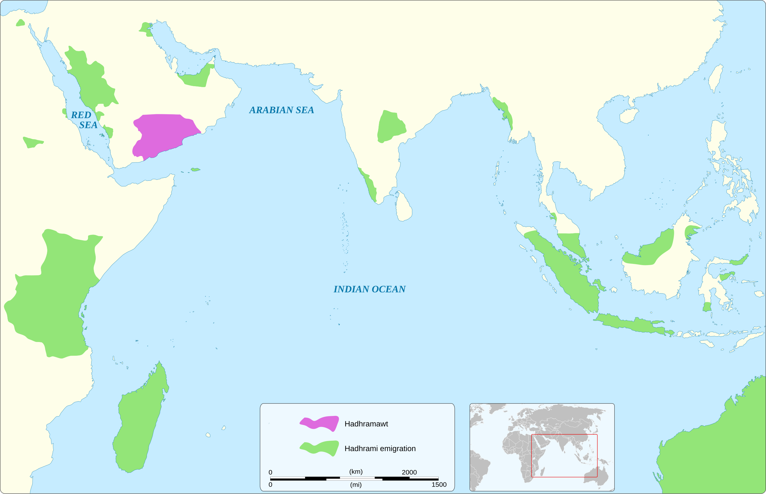
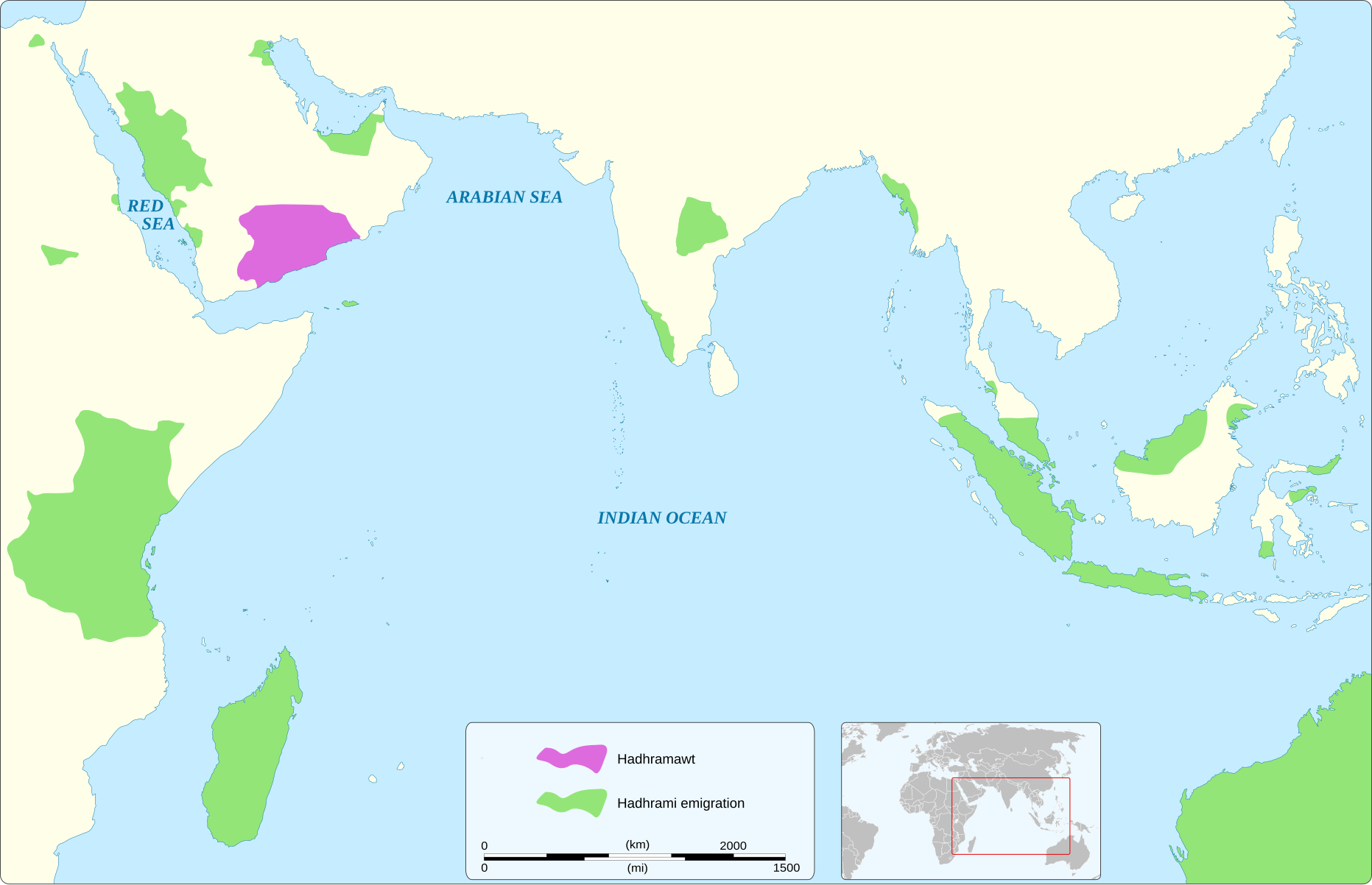
English: Map of Hadhrami emigrations around the world based on the book "On the Edge of Empire: Hadhramawt, Emigration, and the Indian Ocean, 1880s-1930s" by Linda Boxberger
|
|||||||||||||||||||
| Date | ||||||||||||||||||||
| Source |
Own work based on:
|
|||||||||||||||||||
| Author | Goran_tek-en | |||||||||||||||||||
| Permission (Reusing this file) |
This file is licensed under the Creative Commons Attribution-Share Alike 4.0 International license. Attribution: Goran_tek-en
|
|||||||||||||||||||
| SVG development | This vector image was created with Inkscape. |
|||||||||||||||||||
| Object location | | View this and other nearby images on: OpenStreetMap |
|---|

File history
Click on a date/time to view the file as it appeared at that time.
| Date/Time | Thumbnail | Dimensions | User | Comment | |
|---|---|---|---|---|---|
| current | 07:32, 15 January 2025 | | 1,863 × 1,201 (1.64 MB) | Abo Yemen | File uploaded using svgtranslate tool (https://svgtranslate.toolforge.org/). Added translation for ar. |
| 11:52, 14 January 2025 |  | 1,863 × 1,201 (1.63 MB) | Goran tek-en | {{Information |description ={{en|1=Map of Hadhrami emigrations around the world based on the book "On the Edge of Empire: Hadhramawt, Emigration, and the Indian Ocean, 1880s-1930s" by Linda Boxberger}} {{Institution |wikidata=Q1517159}} {{Institution |wikidata=Q4120474}} |date =2025-01-14 |source ={{Own based|Maps template-en.svg|BlankMap-World gray.svg|b1=Sting|b2=LivingShadow}} <br> {{own using}} [https://www.openstreetmap.org/#map=5/6.53/76.64 OpenStreetMap]<br> I... |
File usage
The following 2 pages use this file:
Global file usage
The following other wikis use this file: