
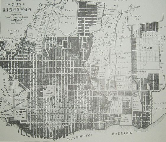
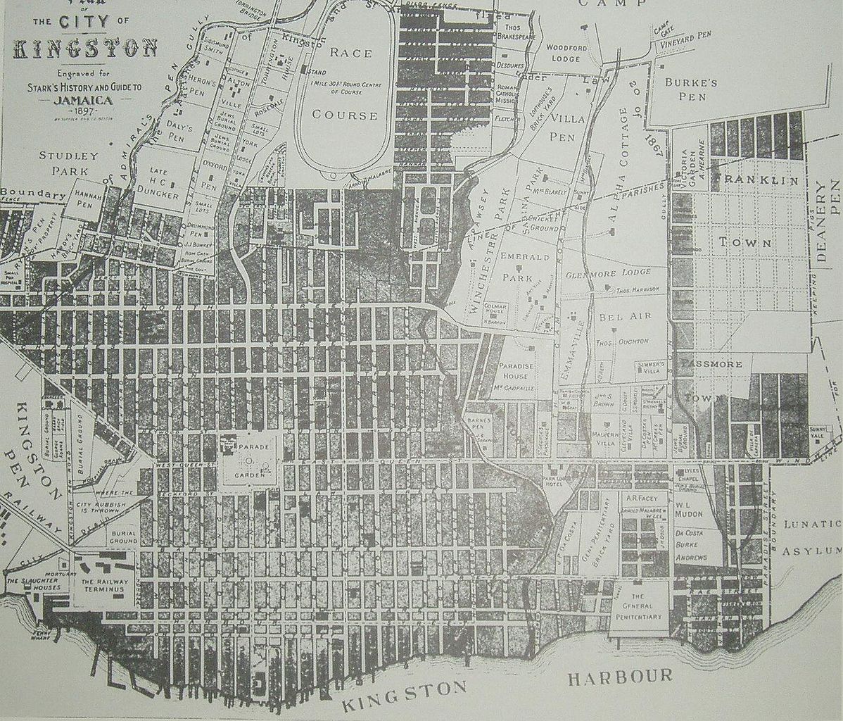
File:Map Kingston 1897.jpg

Size of this preview: 702 × 600 pixels. Other resolutions: 281 × 240 pixels | 562 × 480 pixels | 899 × 768 pixels | 1,198 × 1,024 pixels | 1,500 × 1,282 pixels.
Original file (1,500 × 1,282 pixels, file size: 409 KB, MIME type: image/jpeg)
| This is a file from the Wikimedia Commons. Information from its description page there is shown below. Commons is a freely licensed media file repository. You can help. |
Summary
| Description |
English: map of Kingston Jamaica in the 1890s |
| Date | year 1897 (publication) |
| Source | 1897 map by T.Harrison (died in 1894, 3 years before map printed) |
| Author | T.Harrison (died in 1894) |
Licensing
|
This work is in the public domain in its country of origin and other countries and areas where the copyright term is the author's life plus 70 years or fewer. | |
| This file has been identified as being free of known restrictions under copyright law, including all related and neighboring rights. | |
File history
Click on a date/time to view the file as it appeared at that time.
| Date/Time | Thumbnail | Dimensions | User | Comment | |
|---|---|---|---|---|---|
| current | 11:20, 31 December 2008 | | 1,500 × 1,282 (409 KB) | De Geo | {{Information |Description={{en|1=map of Kingston Jamaica 1897}} |Source=eigen werk (own work) |Author=Bijltjespad |Date=year 1897 |Permission=yes |other_versions=no }} <!--{{ImageUpload|full}}--> |
File usage
The following pages on the English Wikipedia use this file (pages on other projects are not listed):
Global file usage
The following other wikis use this file:
- Usage on bn.wiki.x.io
- Usage on ha.wiki.x.io
- Usage on nl.wiki.x.io
- Usage on pl.wiki.x.io
- Usage on sl.wiki.x.io