
File:Location map United Kingdom Southport.svg

Size of this PNG preview of this SVG file: 534 × 599 pixels. Other resolutions: 214 × 240 pixels | 428 × 480 pixels | 684 × 768 pixels | 912 × 1,024 pixels | 1,824 × 2,048 pixels | 1,094 × 1,228 pixels.
Original file (SVG file, nominally 1,094 × 1,228 pixels, file size: 3.69 MB)
| This is a file from the Wikimedia Commons. Information from its description page there is shown below. Commons is a freely licensed media file repository. You can help. |
Summary
| Description |
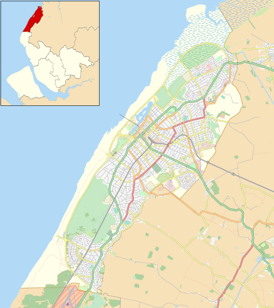
English: Map of Southport, Merseyside, England. Inset shows location within Merseyside.
Equirectangular map projection on WGS 84 datum. Geographic limits:
|
| Date | |
| Source |
This file was derived from: Southport unparished area UK locator map.svg: |
| Author |
|
| Other versions |
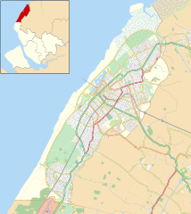
 Location map United Kingdom Southport Central.svg for Southport town centre Location map United Kingdom Southport Central.svg for Southport town centre |

Licensing
| This work contains information from OpenStreetMap, which is made available under the Open Database License (ODbL).
The ODbL does not require any particular license for maps produced from ODbL data. Prior to 1 August 2020, map tiles produced by the OpenStreetMap Foundation were licensed under the CC-BY-SA-2.0 license. Maps produced by other people may be subject to other licences. |
This file is licensed under the Creative Commons Attribution-Share Alike 4.0 International license.
Attribution: © OpenStreetMap contributors. Contains Ordnance Survey data © Crown copyright and database right 2015.
- You are free:
- to share – to copy, distribute and transmit the work
- to remix – to adapt the work
- Under the following conditions:
- attribution – You must give appropriate credit, provide a link to the license, and indicate if changes were made. You may do so in any reasonable manner, but not in any way that suggests the licensor endorses you or your use.
- share alike – If you remix, transform, or build upon the material, you must distribute your contributions under the same or compatible license as the original.
File history
Click on a date/time to view the file as it appeared at that time.
| Date/Time | Thumbnail | Dimensions | User | Comment | |
|---|---|---|---|---|---|
| current | 22:30, 11 April 2017 | | 1,094 × 1,228 (3.69 MB) | Dr Greg | User created page with UploadWizard |
File usage
The following pages on the English Wikipedia use this file (pages on other projects are not listed):
- 1965 Open Championship
- 1971 Open Championship
- 1983 Open Championship
- 1991 Open Championship
- 1998 Open Championship
- 2005 European Amateur Team Championship
- 2005 Women's British Open
- 2013 Senior Open Championship
- 2014 Women's British Open
- Ainsdale
- Birkdale
- Birkdale Palace Hotel
- Blowick
- Church of St Teresa of Avila, Birkdale
- Churchtown, Merseyside
- Crossens
- Haig Avenue
- High Park, Merseyside
- Hillside, Merseyside
- Hillside Golf Club
- Kew, Merseyside
- Marshside, Merseyside
- Meols Cop
- Royal Birkdale Golf Club
- Smedley Hydro
- Southport
- Southport Botanic Gardens
- Southport General Infirmary
- Southport and Ainsdale Golf Club
- Southport and Formby District General Hospital
- St Cuthbert's Church, Churchtown
- St James' Church, Birkdale
- St John's Church, Birkdale
- St Joseph's Church, Birkdale
- St Peter's Church, Birkdale
- Woodvale, Merseyside
- Module:Location map/data/United Kingdom Southport
- Module:Location map/data/United Kingdom Southport/doc
Global file usage
The following other wikis use this file: