
File:Line5068 - Flickr - NOAA Photo Library.jpg
Size of this preview: 800 × 532 pixels. Other resolutions: 320 × 213 pixels | 640 × 426 pixels | 1,024 × 681 pixels | 1,280 × 851 pixels | 3,008 × 2,000 pixels.
Original file (3,008 × 2,000 pixels, file size: 1.23 MB, MIME type: image/jpeg)
| This is a file from the Wikimedia Commons. Information from its description page there is shown below. Commons is a freely licensed media file repository. You can help. |
Summary
| Description |
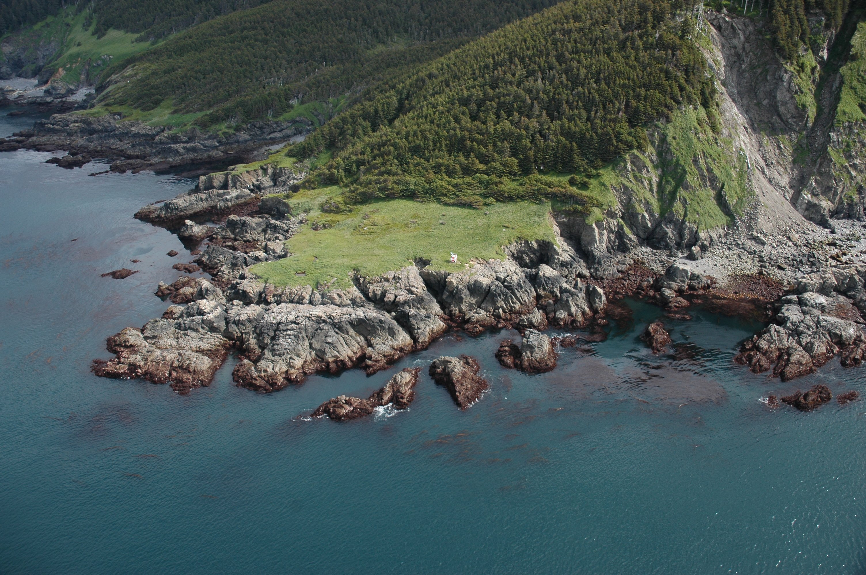
English: Aerial photograph. The navigation light at the SW tip of Elizabeth Island which marks the SE end of Cook Inlet and SW tip of the Kenai Peninsula. Alaska, Lower Cook Inlet, Kenai Peninsula. |
| Date | |
| Source | NOAA Photo Library: line5068 |
| Author | Alaska ShoreZone Program NOAA/NMFS/AKFSC; Courtesy of Mandy Lindeberg, NOAA/NMFS/AKFSC. |
Licensing
This file is licensed under the Creative Commons Attribution 2.0 Generic license.
- You are free:
- to share – to copy, distribute and transmit the work
- to remix – to adapt the work
- Under the following conditions:
- attribution – You must give appropriate credit, provide a link to the license, and indicate if changes were made. You may do so in any reasonable manner, but not in any way that suggests the licensor endorses you or your use.
| This image was originally posted to Flickr by NOAA Photo Library at https://www.flickr.com/photos/51647007@N08/5181463261. It was reviewed on 3 January 2013 by FlickreviewR and was confirmed to be licensed under the terms of the cc-by-2.0. |
This image is in the public domain because it contains materials that originally came from the U.S. National Oceanic and Atmospheric Administration, taken or made as part of an employee's official duties.
|
File history
Click on a date/time to view the file as it appeared at that time.
| Date/Time | Thumbnail | Dimensions | User | Comment | |
|---|---|---|---|---|---|
| current | 16:34, 6 January 2012 | | 3,008 × 2,000 (1.23 MB) | Kobac | {{Information |Description=Aerial photograph. The navigation light at the SW tip of Elizabeth Island which marks the SE end of Cook Inlet and SW tip of the Kenai Peninsula. Alaska, Lower Cook Inlet, Kenai Peninsula. Credit: Alaska ShoreZone Program NOAA |
File usage
The following page uses this file:
Global file usage
The following other wikis use this file:
- Usage on es.wiki.x.io
- Usage on id.wiki.x.io
- Usage on vls.wiki.x.io