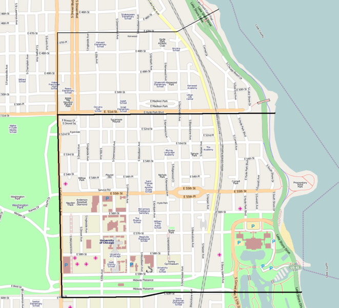
File:Hyde Park Map.png
Appearance

Size of this preview: 661 × 600 pixels. Other resolutions: 265 × 240 pixels | 529 × 480 pixels | 847 × 768 pixels | 1,163 × 1,055 pixels.
Original file (1,163 × 1,055 pixels, file size: 523 KB, MIME type: image/png)
File history
Click on a date/time to view the file as it appeared at that time.
| Date/Time | Thumbnail | Dimensions | User | Comment | |
|---|---|---|---|---|---|
| current | 03:42, 22 April 2009 |  | 1,163 × 1,055 (523 KB) | TonyTheTiger | better detail |
| 03:01, 17 April 2009 |  | 645 × 860 (311 KB) | TonyTheTiger | Cropped version | |
| 02:53, 17 April 2009 |  | 1,260 × 888 (632 KB) | TonyTheTiger | {{Information |Description={{en|1=w:Hyde Park, Chicago map}} |Source=http://www.openstreetmap.org/?lat=41.794&lon=-87.6044&zoom=14&layers=B000FTFT |Author=OpenStreetMap and edited by w:User:TonyTheTiger |Date=2009-04-17 |Permission= |other_versi |
File usage
The following page uses this file:
Global file usage
The following other wikis use this file:
- Usage on ar.wiki.x.io
- Usage on cs.wiki.x.io
- Usage on fa.wiki.x.io
- Usage on he.wiki.x.io
- Usage on pt.wiki.x.io
- Usage on www.wikidata.org
- Usage on zh.wiki.x.io
