
File:GC of the Armed Forces of South Russia Map.png
Size of this preview: 584 × 599 pixels. Other resolutions: 234 × 240 pixels | 468 × 480 pixels | 924 × 948 pixels.
Original file (924 × 948 pixels, file size: 73 KB, MIME type: image/png)
| This is a file from the Wikimedia Commons. Information from its description page there is shown below. Commons is a freely licensed media file repository. You can help. |
Summary
| Description |
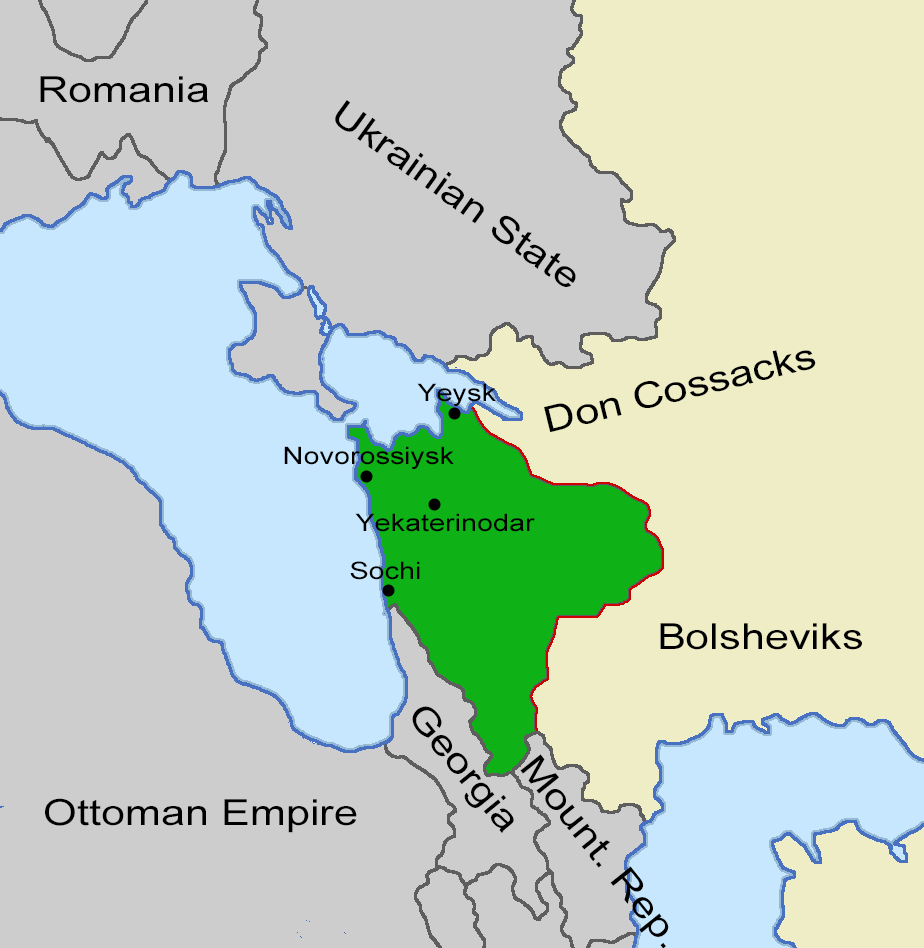
English: Map of the territories governed by the Armed Forces of South Russia in October 1918, whithin Russia (beige). |
| Date | |
| Source | Own work |
| Author | Wario2 |
Licensing
I, the copyright holder of this work, hereby publish it under the following license:
This file is licensed under the Creative Commons Attribution-Share Alike 4.0 International license.
- You are free:
- to share – to copy, distribute and transmit the work
- to remix – to adapt the work
- Under the following conditions:
- attribution – You must give appropriate credit, provide a link to the license, and indicate if changes were made. You may do so in any reasonable manner, but not in any way that suggests the licensor endorses you or your use.
- share alike – If you remix, transform, or build upon the material, you must distribute your contributions under the same or compatible license as the original.
File history
Click on a date/time to view the file as it appeared at that time.
| Date/Time | Thumbnail | Dimensions | User | Comment | |
|---|---|---|---|---|---|
| current | 08:55, 7 October 2022 | | 924 × 948 (73 KB) | DaniCBP | Uploaded while editing "General Command of the Armed Forces of South Russia" on en.wiki.x.io |
File usage
The following page uses this file:
Global file usage
The following other wikis use this file:
- Usage on th.wiki.x.io