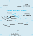
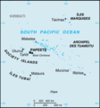
File:French Polynesia-CIA WFB Map.png
Appearance
French_Polynesia-CIA_WFB_Map.png (326 × 351 pixels, file size: 6 KB, MIME type: image/png)
File history
Click on a date/time to view the file as it appeared at that time.
| Date/Time | Thumbnail | Dimensions | User | Comment | |
|---|---|---|---|---|---|
| current | 14:53, 13 August 2010 |  | 326 × 351 (6 KB) | Ras67 | border removed |
| 09:13, 27 March 2005 |  | 330 × 355 (6 KB) | Wolfman~commonswiki | {{CIA-map}} |
File usage
The following page uses this file:
Global file usage
The following other wikis use this file:
- Usage on ast.wiki.x.io
- Usage on en.wikisource.org
- Usage on es.wiki.x.io
- Usage on es.wikinews.org
- Usage on fr.wiki.x.io
- Usage on gl.wiki.x.io
- Usage on hu.wiki.x.io
- Usage on is.wiki.x.io
- Usage on it.wiki.x.io
- Usage on mk.wiki.x.io
- Usage on oc.wiki.x.io
- Usage on pl.wiki.x.io
- Usage on ro.wiki.x.io
- Usage on sk.wiki.x.io
- Tuamotu
- Mururoa
- Hao
- Šablóna:Tuamotu
- Puka-Puka
- Napuka
- Tepoto Nord
- Tepoto Sud
- Hereheretue
- Anuanuraro
- Anuanurunga
- Nukutepipi
- Fangatau
- Fakahina
- Tatakoto
- Akiaki
- Vahitahi
- Nukutavake
- Vairaatea
- Pinaki
- Reao
- Pukarua
- Vanavana
- Tureia
- Tematangi
- Fangataufa
- Rekareka
- Tauere
- Amanu
- Paraoa
- Manuhangi
- Nengonengo
- Ahunui
- Tekokota
View more global usage of this file.


