
File:DhenkanalKart.jpg
No higher resolution available.
DhenkanalKart.jpg (446 × 299 pixels, file size: 170 KB, MIME type: image/jpeg)
| This is a file from the Wikimedia Commons. Information from its description page there is shown below. Commons is a freely licensed media file repository. You can help. |
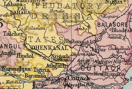
Summary
| Description |
Deutsch: Kartenausschnitt Dhenkanal |
| Date | 1909/31 |
| Source | Imperial Gazetteer of India |
| Author | Regierung von Britisch-Indien. Kartograph J. G. Bartholomew (gest. 1920) |
| Permission (Reusing this file) |
Amtliche Publikation |
Licensing
|
This work is in the public domain in its country of origin and other countries and areas where the copyright term is the author's life plus 70 years or fewer. | |
| This file has been identified as being free of known restrictions under copyright law, including all related and neighboring rights. | |
Original upload log
Transferred from de.wikipedia to Commons by Ireas using CommonsHelper.
The original description page was here. All following user names refer to de.wikipedia.
- 2009-03-20 11:53 Dr. Andreas Birken 446×299× (174540 bytes) {{Information |Beschreibung = Kartenausschnitt Dhenkanal |Quelle = Imperial Gazetteer of India |Urheber = Regierung von Britisch-Indien. Kartograph J. G. Bartholomew (gest. 1920) |Datum = 1909/31 |Genehmigung = Amtliche Publikation |Andere Versionen = |A
File history
Click on a date/time to view the file as it appeared at that time.
| Date/Time | Thumbnail | Dimensions | User | Comment | |
|---|---|---|---|---|---|
| current | 11:44, 28 September 2010 | | 446 × 299 (170 KB) | File Upload Bot (Magnus Manske) | {{BotMoveToCommons|de.wikipedia|year={{subst:CURRENTYEAR}}|month={{subst:CURRENTMONTHNAME}}|day={{subst:CURRENTDAY}}}} {{Information |Description={{de|Kartenausschnitt Dhenkanal<br/> == Lizenz: == }} |Source=T |
File usage
The following pages on the English Wikipedia use this file (pages on other projects are not listed):
Global file usage
The following other wikis use this file:
- Usage on bn.wiki.x.io
- Usage on ca.wiki.x.io
- Usage on de.wiki.x.io
- Usage on fr.wiki.x.io
- Usage on it.wiki.x.io
- Usage on or.wiki.x.io
- Usage on ur.wiki.x.io
- Usage on www.wikidata.org