
File:Chart of the head of navigation of the Potomac River shewing the route of the Alexandria Canal - made in pursuance of a resolution of the Alex'a Canal Company Oct. 1838 LOC 89696869.jpg
Size of this preview: 800 × 446 pixels. Other resolutions: 320 × 178 pixels | 640 × 357 pixels | 1,024 × 570 pixels | 1,280 × 713 pixels | 2,560 × 1,426 pixels | 11,043 × 6,152 pixels.
Original file (11,043 × 6,152 pixels, file size: 8.63 MB, MIME type: image/jpeg)
| This is a file from the Wikimedia Commons. Information from its description page there is shown below. Commons is a freely licensed media file repository. You can help. |
Summary
| Description |
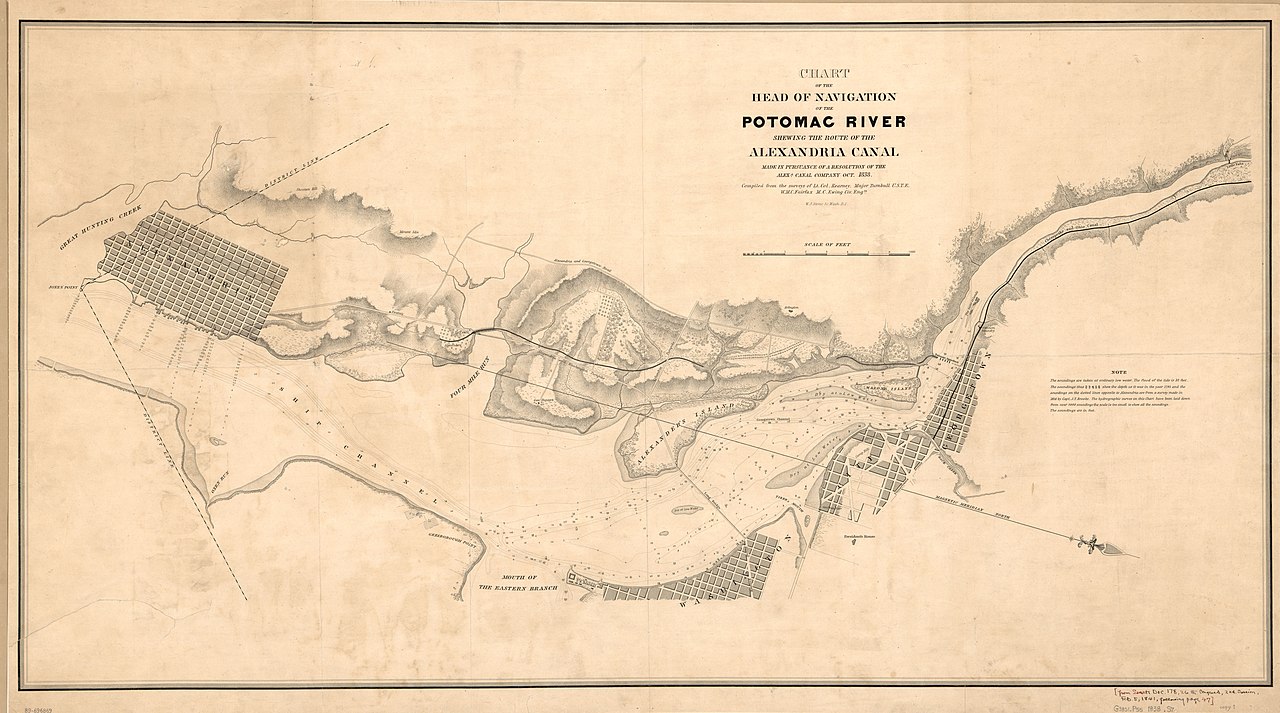
English: Nautical chart of the Potomac estuary within the District of Columbia. Relief shown by hachures. Depths shown by contours and soundings. Oriented with north toward the lower right. Stephenson. Cartography of northern Virginia, pl. 29-30 Includes note. LC copies fold-lined and mounted on cloth backing. Copy 1 annotated in ink in right lower margin: From Senate Doc. 178, 26th Congress, 2nd Session, Feb. 5., 1841, following page 47. Available also through the Library of Congress Web site as a raster image. 2 copies DCP |
||
| Title | Chart of the head of navigation of the Potomac River shewing the route of the Alexandria Canal : made in pursuance of a resolution of the Alex'a Canal Company Oct. 1838 | ||
| Shelf ID | G3851.P55 1838 .S7 | ||
| Date | |||
| Source | https://www.loc.gov/item/89696869/ | ||
| Author | Stone, William James; Kearney, James; Turnbull, Wm. (William); Fairfax, Wilson M. C.; Ewing, Maskell C.; Alexandria Canal Company | ||
| Permission (Reusing this file) |
|
||
| Other versions |
|
||
| Location | Washington D.C. · Alexandria · Potomac River Estuary · Washington · Virginia · United States · District Of Columbia · Alexandria Canal | ||
| Part of | American Memory · Cities And Towns · Catalog · Geography And Map Division | ||
| Subject | Washington (D.C.) · Alexandria · Potomac River Estuary · Washington · Virginia · Nautical Charts · United States · Maps · District Of Columbia · Alexandria Canal (Va.) · Alexandria Canal · Harbors |


Licensing
|
This is a faithful photographic reproduction of a two-dimensional, public domain work of art. The work of art itself is in the public domain for the following reason:
The official position taken by the Wikimedia Foundation is that "faithful reproductions of two-dimensional public domain works of art are public domain".
This photographic reproduction is therefore also considered to be in the public domain in the United States. In other jurisdictions, re-use of this content may be restricted; see Reuse of PD-Art photographs for details. | ||||
File history
Click on a date/time to view the file as it appeared at that time.
| Date/Time | Thumbnail | Dimensions | User | Comment | |
|---|---|---|---|---|---|
| current | 16:05, 9 July 2018 | | 11,043 × 6,152 (8.63 MB) | Fæ | LOC Maps https://www.loc.gov/item/89696869/ #1464 |
File usage
The following pages on the English Wikipedia use this file (pages on other projects are not listed):