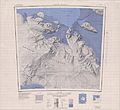
File:C77150s1 Ant.Map Alexandra Mountains.jpg
Appearance

Size of this preview: 654 × 600 pixels. Other resolutions: 262 × 240 pixels | 523 × 480 pixels | 837 × 768 pixels | 1,116 × 1,024 pixels | 2,233 × 2,048 pixels | 4,088 × 3,750 pixels.
Original file (4,088 × 3,750 pixels, file size: 1.86 MB, MIME type: image/jpeg)
File history
Click on a date/time to view the file as it appeared at that time.
| Date/Time | Thumbnail | Dimensions | User | Comment | |
|---|---|---|---|---|---|
| current | 15:37, 3 April 2005 |  | 4,088 × 3,750 (1.86 MB) | Achim Raschka | Map of Antarctica by the United States Antarctic Ressource Center of the US Geological Society. {{PD-US}} Copyrights and Trademarks USGS-authored or produced data and information are in the public domain. While the content of most USGS web pages is in th |
File usage
The following 6 pages use this file:
Global file usage
The following other wikis use this file:
- Usage on bg.wiki.x.io
- Usage on ceb.wiki.x.io
- Usage on de.wiki.x.io
- Edward-VII-Halbinsel
- Sulzberger Bay
- Fisher-Insel
- Cronenwett-Insel
- Marshall-Archipel
- Alexandra Mountains
- Saunders-Küste
- Butler-Gletscher
- Swinburne-Schelfeis
- White Islands (Antarktika)
- Breckinridge Peak
- Mount Nilsen
- Mount Paterson (Rockefeller Mountains)
- Mount Schlossbach
- Rockefeller Mountains
- Mount Frazier
- Mount Jackling
- Mount Fitzsimmons
- Mount Shideler
- Mount Franklin (Antarktika)
- Mount Butler
- Tennant Peak
- Gould Peak
- Strider Rock
- Washington Ridge
- Melbert Rocks
- Fokker Rocks
- Chandler Island
- Olson Island
- Webber Island
- Richter-Gletscher
- Usage on fr.wiki.x.io
- Usage on he.wiki.x.io
- Usage on it.wiki.x.io
View more global usage of this file.

