
File:Bangormap1947.png
Size of this preview: 598 × 600 pixels. Other resolutions: 239 × 240 pixels | 479 × 480 pixels | 766 × 768 pixels | 1,143 × 1,146 pixels.
Original file (1,143 × 1,146 pixels, file size: 2.31 MB, MIME type: image/png)
| This is a file from the Wikimedia Commons. Information from its description page there is shown below. Commons is a freely licensed media file repository. You can help. |
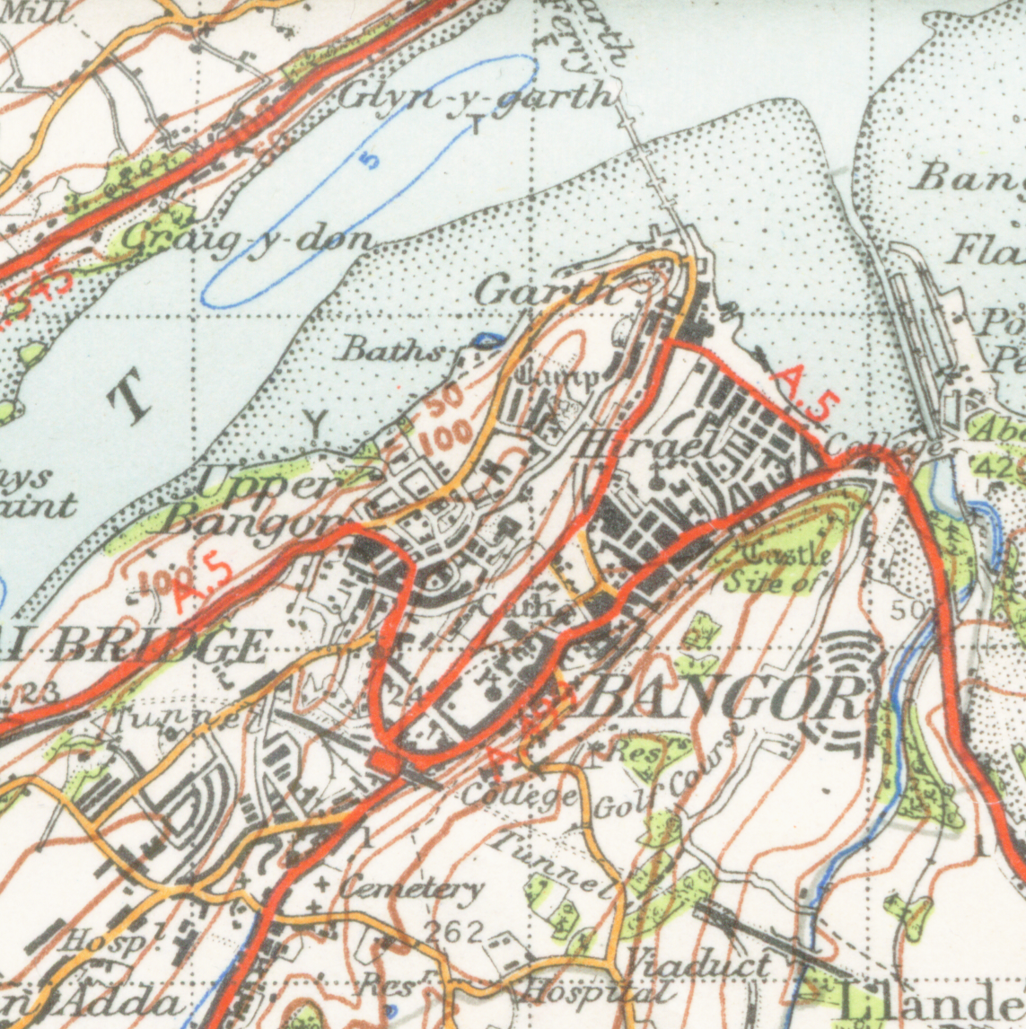
| Description | Map of Bangor from 1947. Scale 1 inch to the mile 600DPI Sheet 107 "snowdon" |
| Date | |
| Source | OS Sheet 107 "snowdon" |
| Author | OS |
This work is an Ordnance Survey map over 50 years old, which is covered by Crown Copyright which in this case expires 50 years after publication. Ordnance Survey does however ask that they be credited and that the date of publication be given.
Any ancillary rights gained through the creation of the electronic version are granted as freely usable under any circumstances.
|
This work created by the United Kingdom Government is in the public domain.
This is because it is one of the following:
HMSO has declared that the expiry of Crown Copyrights applies worldwide (ref: HMSO Email Reply)
|
 |
File history
Click on a date/time to view the file as it appeared at that time.
| Date/Time | Thumbnail | Dimensions | User | Comment | |
|---|---|---|---|---|---|
| current | 18:41, 16 January 2009 | | 1,143 × 1,146 (2.31 MB) | Geni | {{Information |Description=Map of Bangor from 1947. Scale 1 inch to the mile 600DPI Sheet 107 "snowdon" |Source=OS Sheet 107 "snowdon" |Date=1947 |Author=OS |Permission=none needed |other_versions= }} {{oldOS}} Category:Bangor, Wales <!--{{ImageUploa |
File usage
The following page uses this file:
Global file usage
The following other wikis use this file:
- Usage on azb.wiki.x.io
- Usage on hu.wiki.x.io
- Usage on id.wiki.x.io
- Usage on ku.wiki.x.io
- Usage on sco.wiki.x.io
- Usage on vi.wiki.x.io