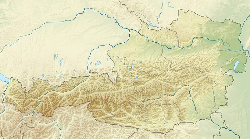
File:Austria relief location map.jpg
Appearance

Size of this preview: 800 × 446 pixels. Other resolutions: 320 × 178 pixels | 640 × 357 pixels | 1,256 × 700 pixels.
Original file (1,256 × 700 pixels, file size: 677 KB, MIME type: image/jpeg)
File history
Click on a date/time to view the file as it appeared at that time.
| Date/Time | Thumbnail | Dimensions | User | Comment | |
|---|---|---|---|---|---|
| current | 09:14, 28 June 2010 |  | 1,256 × 700 (677 KB) | Uwe Dedering | very little border change |
| 12:24, 26 April 2010 |  | 1,256 × 700 (677 KB) | Uwe Dedering | rhine | |
| 12:54, 24 April 2010 |  | 1,256 × 700 (676 KB) | Uwe Dedering | {{Information |Description={{en|1=Location map of Austria}} Equirectangular projection, N/S stretching 150 %. Geographic limits of the map: * N: 49.2° N * S: 46.3° N * W: 9.4° E * E: 17.2° E Made with Natural Earth. Free |
File usage
More than 100 pages use this file. The following list shows the first 100 pages that use this file only. A full list is available.
- Achen Lake
- Almsee
- Alpine skiing at the 1976 Winter Olympics
- Ammer Saddle
- Antiesen
- Archbach
- Attersee (lake)
- Austrian Armed Forces
- Austrian Open (golf)
- Baggersee Innsbruck
- Bielerhöhe Pass
- Bregenz
- Dawinkopf
- Dornbirn
- Drachenhöhle
- Dremelspitze
- Dristner
- FIS Alpine World Ski Championships 1958
- FIS Alpine World Ski Championships 1982
- FIS Alpine World Ski Championships 1991
- FIS Alpine World Ski Championships 2013
- Feldkirch, Vorarlberg
- Feuerspitze
- Four Hills Tournament
- Gaisberg
- Galzig
- Gerlos Pass
- Geschriebenstein
- Gesäuse National Park
- Golica
- Gosau Group
- Grossglockner
- Großharras
- Gößnitzkopf
- Hahnenkamm, Kitzbühel
- Hallstätter See
- Heiterwanger See
- Hermannskogel
- Hietzinger Synagogue
- Hochkönig
- Hoher Dachstein
- Irrsee
- Kanzelhoehe Solar Observatory
- Kitzsteinhorn
- Kleinzell
- Krems an der Donau
- Kreuzeck group
- Lake Constance
- Lake Faak
- Lake Fuschl
- Lake Klopein
- Lake Neusiedl
- Lake Obernberg
- Lake Ossiach
- Lake Toplitz
- Lake Wolfgang
- Lake Zell
- Leopoldstädter Tempel
- List of cities and towns in Austria
- Mariapfarr
- Millstätter See
- Mittelberg
- Mondsee (lake)
- NATO Integrated Air Defense System
- Neudeggergasse Synagogue
- NÖ Open (golf)
- Pazmanitentempel
- Petzen
- Piz Buin
- Plansee
- Polish Synagogue
- Pyramidenkogel
- Radstadt Tauern
- Rettenbach glacier
- Riezlern
- Salzkammergut
- Salzofen cave
- Schiffschul
- Schneeberg (Alps)
- Serles
- Silvrettahorn
- Similaun
- St Anton am Arlberg
- Stadttempel
- Thurn Pass
- Traunsee
- Türkischer Tempel
- Urania, Vienna
- Vienna
- Vienna Observatory
- Vienna Woods
- Wechsel Pass
- Weissensee (Carinthia)
- Weißkugel
- Wildspitze
- Windische Höhe Pass
- Wörthersee
- Zellerrain Pass
- Ziller
- Zimba (mountain)
View more links to this file.
Global file usage
The following other wikis use this file:
- Usage on ab.wiki.x.io
- Usage on als.wiki.x.io
- Usage on am.wiki.x.io
- Usage on an.wiki.x.io
- Usage on ar.wiki.x.io
- Usage on arz.wiki.x.io
- Usage on ast.wiki.x.io
- Usage on as.wiki.x.io
- Usage on azb.wiki.x.io
- Usage on az.wiki.x.io
- Şablon:Yer xəritəsi Avstriya
- Noyzidler gölü
- Arlberq
- Qrosvenediger
- Koralpe
- Hoçkeynig dağı
- İrott-kö
- Zabot su anbarı
- Lyolnbreyn su anbarı
- Krimler şəlaləsi
- Spannagel mağarası
- Tennen dağları
- Venediger dağları
- Vaysenzee gölü
- Leoqanq dağları
- Kalkalpen Milli Parkı
- Aysrizenvelt mağarası
- Zeqortte mağarası
- Grüner-Ze (Ştiriya)
- Usage on ban.wiki.x.io
- Usage on ba.wiki.x.io
- Usage on be-tarask.wiki.x.io
- Usage on be.wiki.x.io
View more global usage of this file.


