
File:Australia Victoria West Wimmera Shire location map.svg

Size of this PNG preview of this SVG file: 323 × 600 pixels. Other resolutions: 129 × 240 pixels | 258 × 480 pixels | 413 × 768 pixels | 551 × 1,024 pixels | 1,102 × 2,048 pixels | 533 × 990 pixels.
Original file (SVG file, nominally 533 × 990 pixels, file size: 512 KB)
| This is a file from the Wikimedia Commons. Information from its description page there is shown below. Commons is a freely licensed media file repository. You can help. |
| Description |
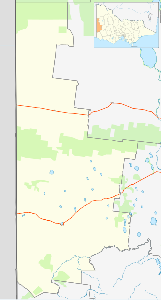
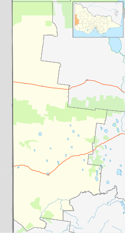
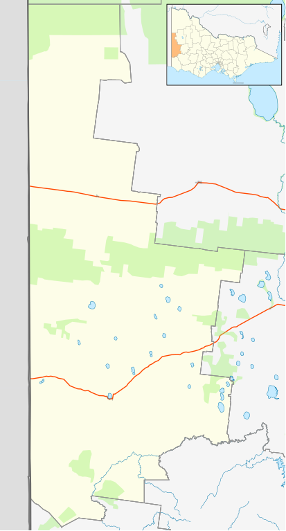
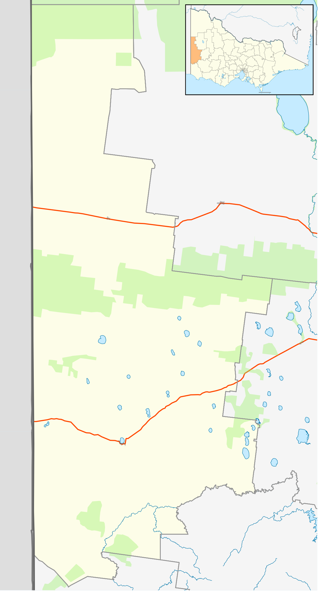
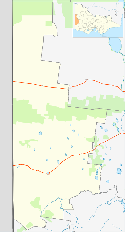
English: Blank map of w:West Wimmera Shire, Victoria, Australia, with the following information shown:
Geographic limits:
|
||
| Source | Own work + VicMap Lite | ||
| Author | Cassowary |

File history
Click on a date/time to view the file as it appeared at that time.
| Date/Time | Thumbnail | Dimensions | User | Comment | |
|---|---|---|---|---|---|
| current | 13:21, 18 February 2011 | | 533 × 990 (512 KB) | Cassowary | {{Information |Description ={{en|1=Blank map of w:West Wimmera Shire, Victoria, Australia, with the following information shown: * LGA boundaries * Coastline, lakes and rivers * Roads and railways * Urban areas * Parks Geographic limits: * North: |
File usage
The following pages on the English Wikipedia use this file (pages on other projects are not listed):
- Apsley, Victoria
- Benayeo, Victoria
- Big Desert, Victoria
- Bringalbert, Victoria
- Broughton, Victoria
- Charam, Victoria
- Chetwynd, Victoria
- Edenhope, Victoria
- Goroke, Victoria
- Gymbowen, Victoria
- Harrow, Victoria
- Kaniva
- Langkoop
- Miga Lake, Victoria
- Minimay, Victoria
- Nurcoung, Victoria
- Serviceton, Victoria
- Shire of West Wimmera
- User:ThylacineHunter/LGA
- User:Viatori/sandbox
- Template:Towns in West Wimmera Shire
- Module:Location map/data/Australia Victoria Shire of West Wimmera
- Module:Location map/data/Australia Victoria Shire of West Wimmera/doc
Global file usage
The following other wikis use this file:
- Usage on ar.wiki.x.io
- Usage on ceb.wiki.x.io
- Usage on fa.wiki.x.io
- Usage on kn.wiki.x.io
- Usage on si.wiki.x.io
- Usage on tr.wiki.x.io
- Usage on uz.wiki.x.io
- Usage on war.wiki.x.io