
File:Arrondissement Veurne Belgium Map.svg

Size of this PNG preview of this SVG file: 556 × 600 pixels. Other resolutions: 222 × 240 pixels | 445 × 480 pixels | 712 × 768 pixels | 949 × 1,024 pixels | 1,899 × 2,048 pixels | 674 × 727 pixels.
Original file (SVG file, nominally 674 × 727 pixels, file size: 3.01 MB)
| This is a file from the Wikimedia Commons. Information from its description page there is shown below. Commons is a freely licensed media file repository. You can help. |
Summary
| Description |
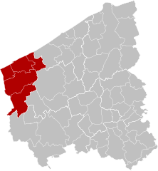
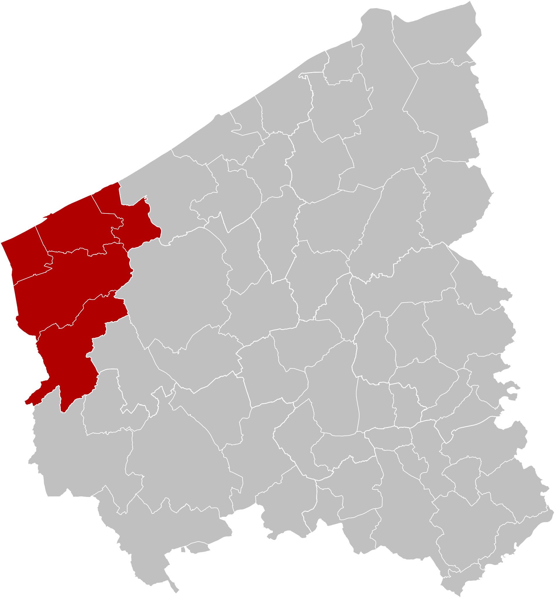
Français : Carte indiquant la localisation d'arrondissement de Furnes en rouge dans la province de Flandre occidentale.
English: Map of Veurne District in red in province of West Flanders, Belgium. |
| Date | |
| Source | Own work |
| Author | OD02fr |
Licensing
I, the copyright holder of this work, hereby publish it under the following license:
This file is licensed under the Creative Commons Attribution-Share Alike 4.0 International license.
- You are free:
- to share – to copy, distribute and transmit the work
- to remix – to adapt the work
- Under the following conditions:
- attribution – You must give appropriate credit, provide a link to the license, and indicate if changes were made. You may do so in any reasonable manner, but not in any way that suggests the licensor endorses you or your use.
- share alike – If you remix, transform, or build upon the material, you must distribute your contributions under the same or compatible license as the original.
File history
Click on a date/time to view the file as it appeared at that time.
| Date/Time | Thumbnail | Dimensions | User | Comment | |
|---|---|---|---|---|---|
| current | 16:43, 27 September 2019 | | 674 × 727 (3.01 MB) | OD02fr | User created page with UploadWizard |
File usage
The following page uses this file:
Global file usage
The following other wikis use this file:
- Usage on et.wiki.x.io
- Usage on fr.wiki.x.io
- Usage on li.wiki.x.io
- Usage on nl.wiki.x.io
- Usage on nl.wikivoyage.org
- Usage on www.wikidata.org
- Usage on zea.wiki.x.io
- Usage on zh.wiki.x.io