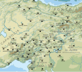
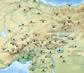
File:Arab-Byzantine frontier zone-es.svg
Appearance

Size of this PNG preview of this SVG file: 620 × 600 pixels. Other resolutions: 248 × 240 pixels | 496 × 480 pixels | 794 × 768 pixels | 1,058 × 1,024 pixels | 2,117 × 2,048 pixels | 1,483 × 1,435 pixels.
Original file (SVG file, nominally 1,483 × 1,435 pixels, file size: 11.67 MB)
File history
Click on a date/time to view the file as it appeared at that time.
| Date/Time | Thumbnail | Dimensions | User | Comment | |
|---|---|---|---|---|---|
| current | 10:23, 16 August 2019 |  | 1,483 × 1,435 (11.67 MB) | Rowanwindwhistler | New version: Projection:EPSG 2186 Topography & shade: USGS GMTED2010 Rivers, Coast, Sea, land: Natural Earth Location of cities/towns: Wikipedia coordinates (mostly) |
| 10:14, 21 January 2018 |  | 1,705 × 1,498 (2.63 MB) | Rowanwindwhistler | Fake text | |
| 20:18, 23 May 2016 |  | 1,705 × 1,498 (1.85 MB) | Rowanwindwhistler | Raster background removed | |
| 07:19, 5 April 2016 |  | 1,705 × 1,498 (4.11 MB) | Rowanwindwhistler | User created page with UploadWizard |
File usage
The following page uses this file:
Global file usage
The following other wikis use this file:
- Usage on ast.wiki.x.io
- Usage on es.wiki.x.io
- Usage on eu.wiki.x.io


