
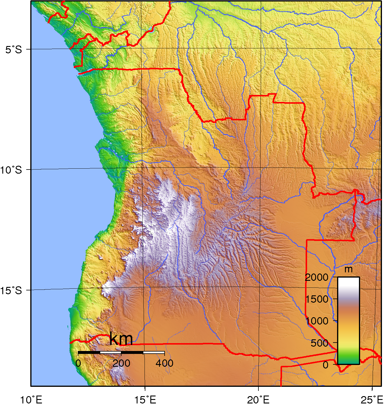
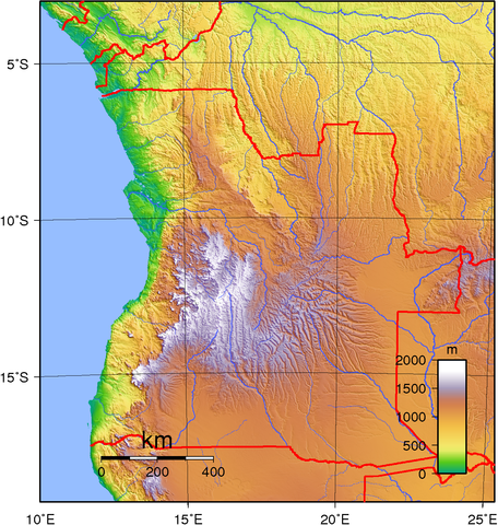
File:Angola Topography.png
Size of this preview: 570 × 600 pixels. Other resolutions: 228 × 240 pixels | 456 × 480 pixels | 730 × 768 pixels | 973 × 1,024 pixels | 1,318 × 1,387 pixels.
Original file (1,318 × 1,387 pixels, file size: 2.41 MB, MIME type: image/png)
| This is a file from the Wikimedia Commons. Information from its description page there is shown below. Commons is a freely licensed media file repository. You can help. |
Summary
| Description | Topographic map of Angola. Created with GMT from public domain GLOBE data. |
| Date | |
| Source | Own work |
| Author | Sadalmelik |
Licensing
| This work has been released into the public domain by its author, I, Sadalmelik. This applies worldwide. In some countries this may not be legally possible; if so: I, Sadalmelik grants anyone the right to use this work for any purpose, without any conditions, unless such conditions are required by law. |
File history
Click on a date/time to view the file as it appeared at that time.
| Date/Time | Thumbnail | Dimensions | User | Comment | |
|---|---|---|---|---|---|
| current | 18:58, 29 June 2007 | | 1,318 × 1,387 (2.41 MB) | Sadalmelik | better data/colours |
| 21:46, 21 June 2007 |  | 1,313 × 1,387 (2.08 MB) | Sadalmelik | {{Information |Description=Topographic map of Angola. Created with GMT from public domain GLOBE data. |Source=self-made |Date=June 21, 2007 |Author= Sadalmelik }} Category:Maps of Angola Category:Topographic maps of Africa |
File usage
The following 5 pages use this file:
Global file usage
The following other wikis use this file:
- Usage on af.wiki.x.io
- Usage on ast.wiki.x.io
- Usage on bg.wiki.x.io
- Usage on bn.wiki.x.io
- Usage on ca.wiki.x.io
- Usage on da.wiki.x.io
- Usage on el.wiki.x.io
- Usage on eo.wiki.x.io
- Usage on es.wiki.x.io
- Usage on et.wiki.x.io
- Usage on fa.wiki.x.io
- Usage on haw.wiki.x.io
- Usage on hu.wiki.x.io
- Usage on id.wiki.x.io
- Usage on ig.wiki.x.io
- Usage on io.wiki.x.io
- Usage on it.wiki.x.io
- Usage on ja.wiki.x.io
- Usage on ka.wiki.x.io
- Usage on kn.wiki.x.io
- Usage on lt.wiki.x.io
- Usage on mdf.wiki.x.io
- Usage on mzn.wiki.x.io
- Usage on nn.wiki.x.io
- Usage on pt.wiki.x.io
- Usage on ro.wiki.x.io
- Usage on si.wiki.x.io
- Usage on sr.wiki.x.io
- Usage on sv.wiki.x.io
- Usage on szy.wiki.x.io
- Usage on trv.wiki.x.io
- Usage on tum.wiki.x.io
- Usage on uk.wiki.x.io
- Usage on vep.wiki.x.io
- Usage on zh.wiki.x.io