
File:2198Pangasinan-Nueva Vizcaya Road Rosales 49.jpg
Size of this preview: 800 × 600 pixels. Other resolutions: 320 × 240 pixels | 640 × 480 pixels | 1,024 × 768 pixels | 1,280 × 960 pixels | 2,560 × 1,920 pixels | 4,608 × 3,456 pixels.
Original file (4,608 × 3,456 pixels, file size: 5.83 MB, MIME type: image/jpeg)
| This is a file from the Wikimedia Commons. Information from its description page there is shown below. Commons is a freely licensed media file repository. You can help. |
Summary
| Description |
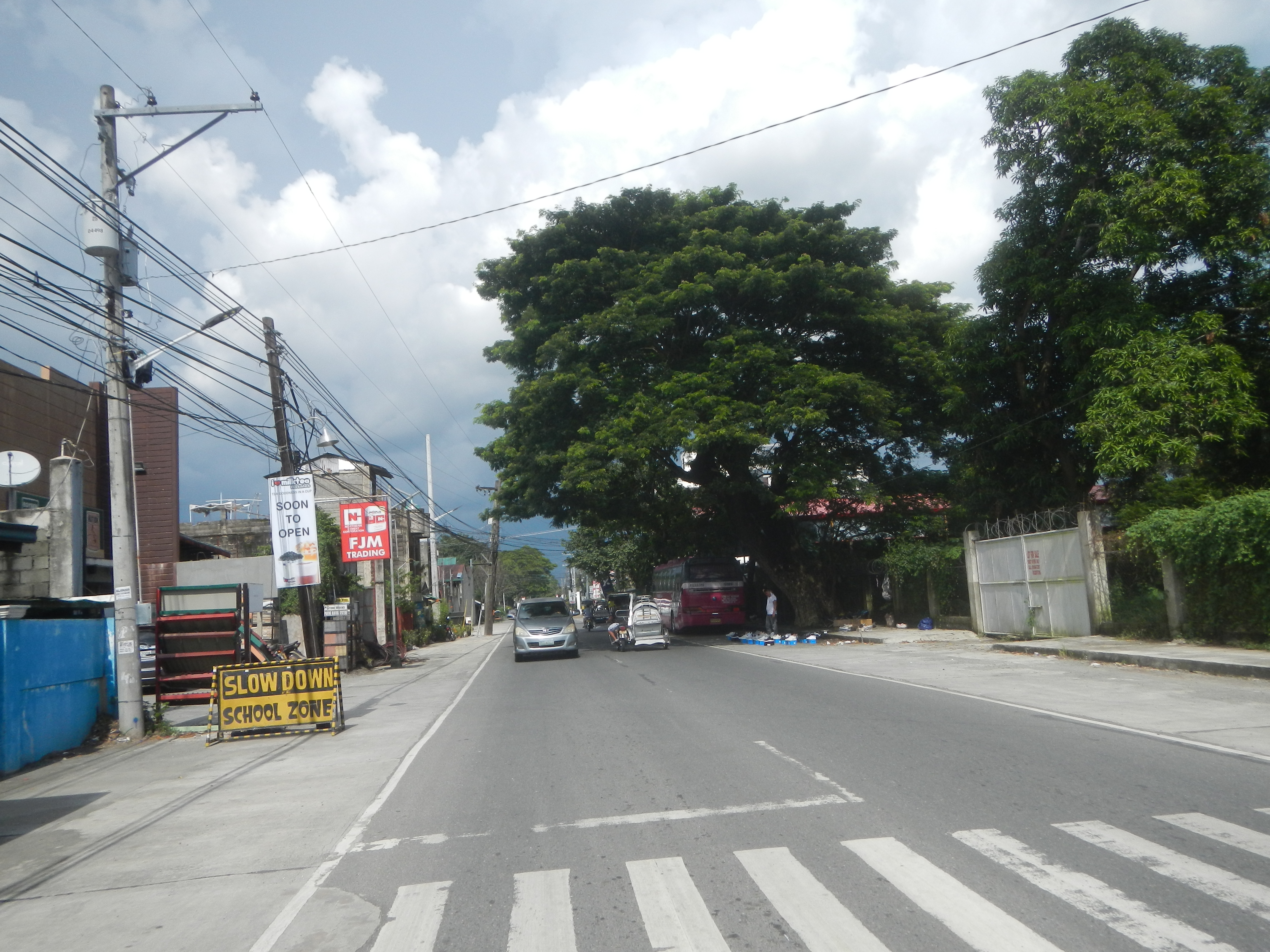
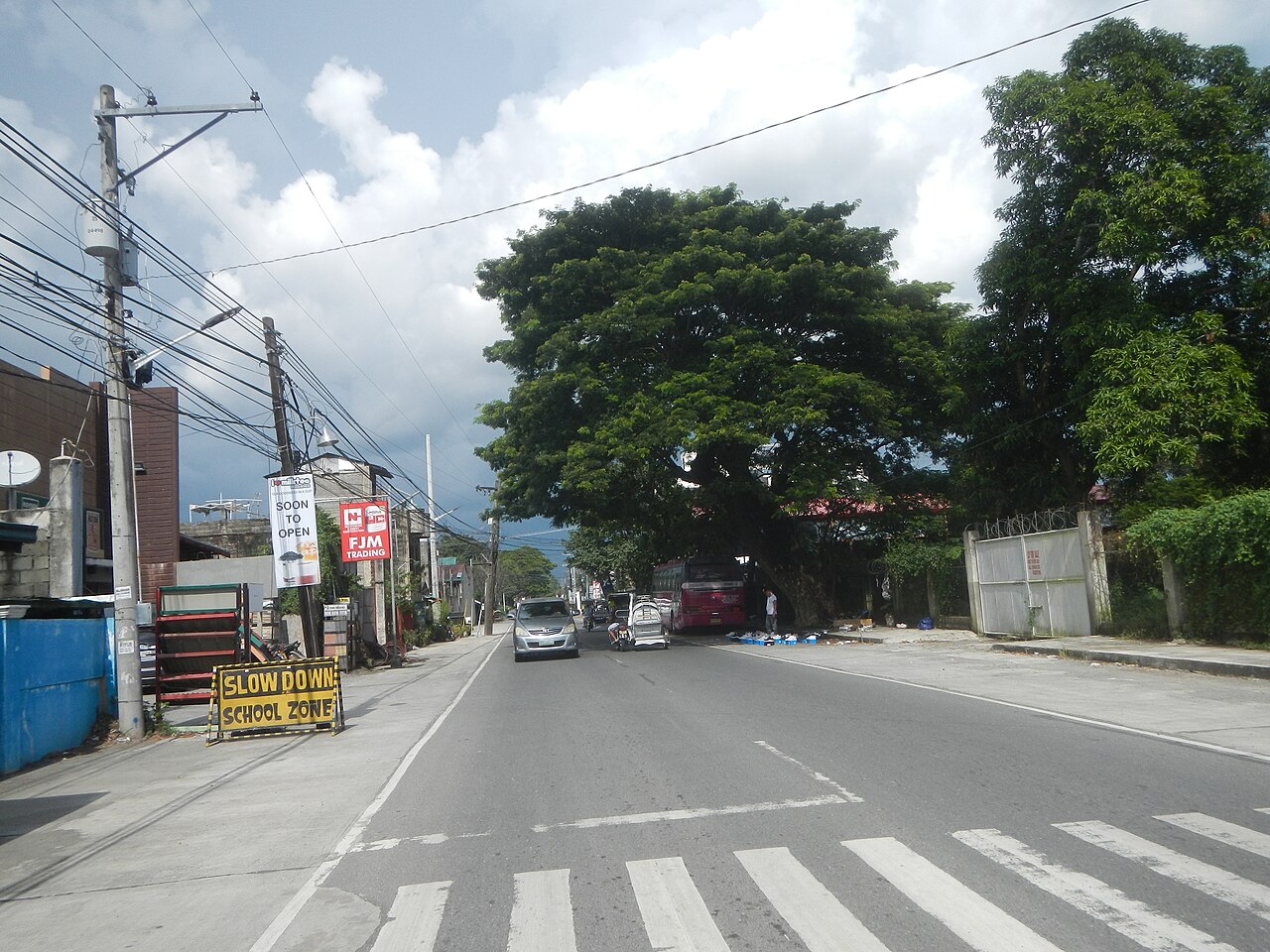
English: Pangasinan-Nueva Vizcaya Road (Carmen East, Tomana East-Tomana West, San Pedro West, San Pedro East, Balincanaway & Bakit-Bakit, Rosales, Pangasinan) Photos taken under the conditions of Typhoon Mitag (Onyok) Category:Typhoon Mitag (2019) Bakit-Bakit Junction - Umingan Road (Rosales) Category:Pangasinan-Nueva Vizcaya Road (Rosales section of Pangasinan-Nueva Ecija Road) Category:Sitios and puroks of the Philippines Sitio List of barangays in Pangasinan, Barangays of Pangasinan, Barangays Carmen East 15°53'0"N 120°36'18"E Tomana East and Tomana West, Rosales, Pangasinan 15°53'20"N 120°36'47"E San Pedro West, Rosales, Pangasinan 15.8962, 120.6370 San Pedro East, Rosales, Pangasinan 15.8969, 120.6455
Balingcanaway, Rosales, Pangasinan 15.8920, 120.6520 Bakit-Bakit 15.8780, 120.6503 Rosales, Pangasinan, Pangasinan Province Pangasinan-Nueva Ecija Road (Rosales) from MacArthur Highway or Manila North Road MacArthur Highway (Rosales, Pangasinan) Philippine highway network (Note: Judge Florentino Floro, the owner, to repeat, Donor Florentino Floro of all these photos hereby donate gratuitously, freely and unconditionally Judge Floro all these photos to and for Wikimedia Commons, exclusively, for public use of the public domain, and again without any condition whatsoever). |
| Date | |
| Source | Own work |
| Author | Judgefloro |
| Camera location | | View this and other nearby images on: OpenStreetMap |
|---|
Balingcanaway, Rosales, Pangasinan 15.8920, 120.6520
Licensing
I, the copyright holder of this work, hereby publish it under the following license:
| This file is made available under the Creative Commons CC0 1.0 Universal Public Domain Dedication. | |
| The person who associated a work with this deed has dedicated the work to the public domain by waiving all of their rights to the work worldwide under copyright law, including all related and neighboring rights, to the extent allowed by law. You can copy, modify, distribute and perform the work, even for commercial purposes, all without asking permission.
|
File history
Click on a date/time to view the file as it appeared at that time.
| Date/Time | Thumbnail | Dimensions | User | Comment | |
|---|---|---|---|---|---|
| current | 08:07, 30 September 2019 | | 4,608 × 3,456 (5.83 MB) | Judgefloro | User created page with UploadWizard |
File usage
No pages on the English Wikipedia use this file (pages on other projects are not listed).