Đồng Xoài
Appearance
(Redirected from Dong Xoai)
You can help expand this article with text translated from the corresponding article in Vietnamese. (March 2009) Click [show] for important translation instructions.
|
Đồng Xoài
Thành phố Đồng Xoài | |
|---|---|
| Đồng Xoài City | |
 | |
 | |
| Coordinates (region:VN_type:city): 11°31′1″N 106°50′21″E / 11.51694°N 106.83917°E | |
| Country | |
| Province | Bình Phước Province |
| Area | |
| • Total | 169.05 km2 (65.27 sq mi) |
| Population (2018) | |
| • Total | 150,052 [1] |
| • Density | 887/km2 (2,300/sq mi) |
| Time zone | UTC+7 (Indochina Time) |
| Climate | Am |
| Website | dongxoai.binhphuoc.gov.vn |
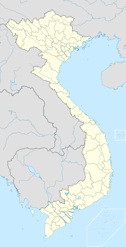
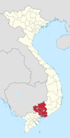
Đồng Xoài () is the capital city of Bình Phước Province in the Southeast region of Vietnam. The city was the site of the 1965 Battle of Đồng Xoài during the Vietnam War. As of 2018, the district had a population of 150,052, and a total area of 169.05 km².[1][2] The district capital lies at Đồng Xoài.[3] Đồng Xoài is located on an elevation of 88.63 m above the sea level, 101 km north from Ho Chi Minh City, 90 km from the Hoa Lư border crossing. Đồng Xoài is connected through national highway 14.
Administrative division
[edit]Đồng Xoài consists of 6 wards (phường) and 2 communes (xã):
- Wards: Tân Bình, Tân Đồng, Tân Phú, Tân Thiện, Tân Xuân, Tiến Thành
- Communes: Tân Thành, Tiến Hưng.
Climate
[edit]| Climate data for Đồng Xoài (Đồng Phú) | |||||||||||||
|---|---|---|---|---|---|---|---|---|---|---|---|---|---|
| Month | Jan | Feb | Mar | Apr | May | Jun | Jul | Aug | Sep | Oct | Nov | Dec | Year |
| Record high °C (°F) | 37.7 (99.9) |
38.2 (100.8) |
40.6 (105.1) |
40.2 (104.4) |
40.0 (104.0) |
36.5 (97.7) |
35.5 (95.9) |
35.1 (95.2) |
35.5 (95.9) |
35.7 (96.3) |
35.0 (95.0) |
36.2 (97.2) |
40.6 (105.1) |
| Mean daily maximum °C (°F) | 32.9 (91.2) |
34.4 (93.9) |
35.5 (95.9) |
35.6 (96.1) |
34.2 (93.6) |
32.5 (90.5) |
31.9 (89.4) |
31.7 (89.1) |
31.6 (88.9) |
31.8 (89.2) |
32.1 (89.8) |
31.9 (89.4) |
33.0 (91.4) |
| Daily mean °C (°F) | 25.3 (77.5) |
26.4 (79.5) |
27.8 (82.0) |
28.4 (83.1) |
28.0 (82.4) |
27.0 (80.6) |
26.5 (79.7) |
26.4 (79.5) |
26.2 (79.2) |
26.1 (79.0) |
25.7 (78.3) |
25.1 (77.2) |
26.6 (79.9) |
| Mean daily minimum °C (°F) | 19.8 (67.6) |
20.5 (68.9) |
22.3 (72.1) |
23.9 (75.0) |
24.3 (75.7) |
23.9 (75.0) |
23.5 (74.3) |
23.5 (74.3) |
23.3 (73.9) |
22.9 (73.2) |
21.8 (71.2) |
20.3 (68.5) |
22.5 (72.5) |
| Record low °C (°F) | 11.9 (53.4) |
15.1 (59.2) |
16.8 (62.2) |
19.2 (66.6) |
20.9 (69.6) |
21.3 (70.3) |
20.9 (69.6) |
20.6 (69.1) |
20.7 (69.3) |
17.8 (64.0) |
15.2 (59.4) |
14.3 (57.7) |
11.9 (53.4) |
| Average rainfall mm (inches) | 9.9 (0.39) |
15.8 (0.62) |
48.2 (1.90) |
150.5 (5.93) |
260.2 (10.24) |
327.0 (12.87) |
348.7 (13.73) |
374.5 (14.74) |
430.3 (16.94) |
362.1 (14.26) |
156.7 (6.17) |
46.1 (1.81) |
2,538.7 (99.95) |
| Average rainy days | 1.8 | 1.9 | 4.6 | 10.6 | 18.6 | 21.8 | 23.8 | 23.8 | 24.8 | 22.5 | 12.7 | 4.9 | 171.8 |
| Average relative humidity (%) | 71.0 | 69.1 | 68.9 | 74.4 | 80.3 | 84.4 | 86.1 | 87.1 | 87.6 | 86.2 | 81.4 | 74.8 | 79.3 |
| Mean monthly sunshine hours | 253.4 | 243.6 | 260.0 | 245.1 | 230.8 | 185.3 | 179.3 | 167.2 | 157.7 | 191.4 | 211.9 | 225.9 | 2,552 |
| Source: Vietnam Institute for Building Science and Technology[4] | |||||||||||||
References
[edit]- ^ a b "Đồng Xoài (City, Bình Phước, Vietnam) - Population Statistics, Charts, Map and Location".
- ^ "Introduction to Đồng Xoài". Retrieved Feb 9, 2014.
- ^ "Districts of Vietnam". Retrieved January 21, 2017.
- ^ "Vietnam Institute for Building Science and Technology" (PDF).


