Boalemo Regency
Boalemo Regency
Kabupaten Boalemo | |
|---|---|
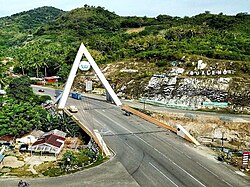
 Soeharto bridge in Tilamuta | |
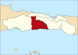
 Location within Gorontalo | |
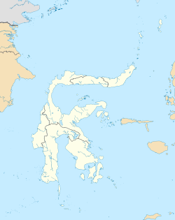
Location in Sulawesi | |
| Coordinates: 0°39′N 122°19′E / 0.650°N 122.317°E | |
| Country | Indonesia |
| Province | Gorontalo |
| Capital | Tilamuta |
| Founded | 12 October 1999 |
| Government | |
| • Regent | Darwis Moridu |
| • Vice Regent | Vacant |
| Area | |
• Total | 706.90 sq mi (1,830.87 km2) |
| Population (mid 2023 estimate)[1] | |
• Total | 151,337 |
| • Density | 210/sq mi (83/km2) |
| Time zone | UTC+8 (ICST) |
| Area code | (+62) 443 |
| Website | portal |
Boalemo is a regency of Gorontalo Province, Indonesia. It is located on the northern peninsula of the island of Sulawesi. It was established in 1999 under Law Number (Undang-Undang Nomor) 50/1999. It has an area of 1,830.87 km2, and had a population of 129,253 at the 2010 Census[2] and 145,868 at the 2020 census;[3] the official estimate as at mid 2023 was 151,337 (comprising 77,099 males and 74,238 females).[1] The seat of the regency administration is the town of Tilamuta.
Administrative Districts
[edit]Boalemo Regency is now divided into seven districts (kecamatan), tabulated below with their areas and their populations at the 2010 Census[2] and 2020 Census,[3] together with the official estimates as at mid 2023.[1] The table also includes the locations of the district administrative centres, the number of administrative villages (all classed as rural desa) in each district, and its postal codes.
| Kode Wilayah |
Name of District (kecamatan) |
Area in km2 |
Pop'n Census 2010 |
Pop'n Census 2020 |
Pop'n Estimate mid 2023 |
Admin centre |
No. of villages |
Post codes |
|---|---|---|---|---|---|---|---|---|
| 75.02.05 | Mananggu (a) | 300.92 | 11,500 | 12,854 | 13,360 | Tabulo | 9 | 96265 |
| 75.02.04 | Tilamuta (b) | 190.63 | 26,417 | 30,230 | 31,371 | Modelomo | 12 | 96263 |
| 75.02.03 | Dulupi (c) | 300.92 | 15,222 | 17,274 | 17,711 | Dulupi | 8 | 96267 |
| 75.02.06 | Botumoito (d) | 487.38 | 14,126 | 15,339 | 15,876 | Patoameme | 9 | 96264 |
| 75.02.01 | Paguyaman | 195.43 | 29,753 | 33,912 | 35,278 | Molombulahe | 22 | 96260 |
| 75.02.02 | Wonosari | 236.08 | 24,818 | 28,398 | 29,207 | Bongo II | 14 | 96262 |
| 75.02.07 | Paguyaman Pantai | 119.45 | 7,417 | 8,349 | 8,806 | Bubaa | 8 | 96262 |
| Totals | 1,830.87 | 129,253 | 145,868 | 151,609 | Tilamuta | 82 |
Notes: (a) including 7 offshore islands. (b) including 10 offshore islands. (c) including 2 offshore islands. (d) including 2 offshore islands.
References
[edit]External links
[edit] Media related to Boalemo Regency at Wikimedia Commons
- (in Indonesian) Official website
0°39′N 122°19′E / 0.650°N 122.317°E


