Battle of Vozuća
| Battle of Vozuća | |||||||
|---|---|---|---|---|---|---|---|
| Part of the Bosnian War | |||||||
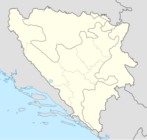
Location of Vozuća | |||||||
| |||||||
| Belligerents | |||||||
|
|
| ||||||
| Commanders and leaders | |||||||
|
|
| ||||||
| Units involved | |||||||
| Strength | |||||||
|
|
| ||||||
| Casualties and losses | |||||||
|
|
| ||||||
The Battle of Vozuća (Bosnian: Bitka za Vozuću) was an attack by the 3rd Corps of the Army of the Republic of Bosnia and Herzegovina and the foreign troops of the Bosnian mujahideen on 10 September 1995 against the strategically important Army of Republika Srpska-held village of Vozuća, in the municipality of Zavidovići during the Bosnian War.[2]
The Attack
[edit]
The attack itself was carried out by the El Mudžahid Detachment of the 3rd Corps, accompanied by some regular members of the ARBIH.[3][4] The attack had already been planned in May 1995 and was carried out in three phases. The first phase was called "Crveni lav" (Red Lion), the main goal of which was to cut off the communication with the VRS in Vozuća. This succeeded and pushed back the Serb forces. The second phase was called "Battle for pride”, the goal of which was to prepare refugees from Srebrenica and Žepa to move into the area after it had been liberated. In fact, after the attack, only a small number of people arrived at the destroyed Vozuća area.[5][6]
Final phase
[edit]The final attack, which was code named "Uragan", (English: Hurricane) started on 10 September and ended the same day with the total victory of the Bosnian forces. The Army and the Mujahideen were aided by the Black Swans, a special forces unit.[2] The Bosnian forces continued advancing through the Ozren area.[7]
Aftermath
[edit]After the takeover of the village, the Mujahideen captured and killed some 50 Serbs, abusing, torturing, stabbing and ritually beheading some of the prisoners.[8] Bosnian general Rasim Delić was indicted on war crimes charges by the ICTY for crimes committed by the Mujahideen unit under his control, part of which dealt with the Vozuća case, though he was acquitted for those counts.[9] In 2016, former Bosnian Army Third Corps commander Sakib Mahmuljin was put on trial for having failed to prevent the murders and torture of Bosnian Serbs by members of his Mujahideen unit in the Vozuća and Zavidovići areas.[8] He was sentenced to 10 years in first instance in January 2021.[10]
References
[edit]- ^ https://saff.ba/muatez-bilah-heroj-koji-je-pokorio-cetnike-na-vozucoj
- ^ a b "Slobodna Bosna, War crimes: "Vozuca case", six years later, 9/13/01". Archived from the original on 2 April 2015. Retrieved 14 January 2015.
- ^ Library Information and Research Service, "The Middle East", Index Page 31
- ^ ICTY transcript, September 24 2007 Archived April 9, 2008, at the Wayback Machine
- ^ "Slobodna Bosna, War crimes: "Vozuca case", six years later, 9/13/01". Retrieved 14 January 2015.
- ^ Battle for Vozuća - The Afghan-Bosnian Mujahideen Network in Europe
- ^ "SLOBODNA DALMACIJA, ETVRTAK 27. rujna 2001. - teme dana". Retrieved 14 January 2015.
- ^ a b Dzidic, Denis (25 January 2016). "Report Probes Mujahideen Killings During Bosnian War". Balkan Insight.
- ^ "Rasim Delić Sentenced to Three Years for Cruel Treatment". ICTY.org. International Criminal Tribunal for the former Yugoslavia. 15 September 2008.
- ^ "Army of BiH commander Mahmuljin sentenced to 10 years in prison for war crime". fena.ba. 22 January 2021.
Further reading
[edit]- Balkan Battlegrounds: A Military History of the Yugoslav Conflict, Volume 1. Central Intelligence Agency, Office of Russian and European Analysis. 2002. ISBN 978-0160664724.

