Čtveřín
Čtveřín | |
|---|---|
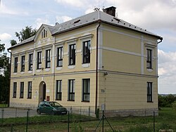
 Municipal office | |
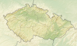
| Coordinates: 50°35′33″N 15°6′0″E / 50.59250°N 15.10000°E | |
| Country | |
| Region | Liberec |
| District | Liberec |
| First mentioned | 1394 |
| Area | |
• Total | 4.95 km2 (1.91 sq mi) |
| Elevation | 274 m (899 ft) |
| Population (2024-01-01)[1] | |
• Total | 607 |
| • Density | 120/km2 (320/sq mi) |
| Time zone | UTC+1 (CET) |
| • Summer (DST) | UTC+2 (CEST) |
| Postal code | 463 45 |
| Website | ctverin-doubi |
Čtveřín (German: Stwerschin) is a municipality and village in Liberec District in the Liberec Region of the Czech Republic. It has about 600 inhabitants.
Administrative parts
[edit]The village of Doubí is an administrative part of Čtveřín.
Geography
[edit]Čtveřín is located about 17 kilometres (11 mi) south of Liberec. It lies in the Jičín Uplands. The highest point is at 380 m (1,250 ft) above sea level. The stream Čtveřínský potok flows through the municipality.
History
[edit]The first written mention of Čtveřín is from 1394. Doubí was first mentioned in 1388. From 1456, it was part of the Malá Skála estate.[2]
After the abolition of the manorialism in 1850, Čtveřín with the nearby villages of Doubí, Husa (today a part of Paceřice) and Sychrov became a sovereign municipality.[3] In 1961, Sychrov became a municipality and Čtveřín was amalgamated into it. Since 1990, Čtveřín has been a separate municipality again.[4]
Demographics
[edit]
|
|
| ||||||||||||||||||||||||||||||||||||||||||||||||||||||
| Source: Censuses[5][6] | ||||||||||||||||||||||||||||||||||||||||||||||||||||||||
Transport
[edit]The D10 motorway runs through the southern part of the municipality.
Čtveřín is located on the Liberec–Stará Paka railway line and is served by the Doubí u Turnova station in Doubí.
Sights
[edit]
The most notable historic monuments are the sculpture of Calvary in Čtveřín and the Chapel of the Guardian Angel in Doubí. A landmark is the former primary school, today used as the municipal office.[7]
References
[edit]- ^ "Population of Municipalities – 1 January 2024". Czech Statistical Office. 2024-05-17.
- ^ "Dějiny Čtveřína v nejstarších písemných pramenech" (in Czech). Obec Čtveřín. Retrieved 2022-04-08.
- ^ "Od obecní samosprávy k samostatnému státu" (in Czech). Obec Čtveřín. Retrieved 2022-04-08.
- ^ "Historický lexikon obcí České republiky 1869–2011" (in Czech). Czech Statistical Office. 2015-12-21. p. 73.
- ^ "Historický lexikon obcí České republiky 1869–2011" (in Czech). Czech Statistical Office. 2015-12-21.
- ^ "Population Census 2021: Population by sex". Public Database. Czech Statistical Office. 2021-03-27.
- ^ "Představujeme obce Turnovska: Čtveřín" (in Czech). Turnovsko v akci. Retrieved 2022-04-08.
External links
[edit]


